Every night could be an aurora night. Don't Miss Out
Experience nature at its rawest as the Iceland hiking trails take you across rugged peaks, icy plateaus, and ancient lava flows.
Hiking in Iceland is an unforgettable adventure through diverse landscapes, from glaciers and volcanoes to waterfalls and geothermal valleys. Routes like the Laugavegur trail, Fimmvörðuháls trail, and the Landmannalaugar hike take you deep into the Highlands, where nature remains wild and unspoiled. Whether you’re planning a multi-day Iceland trekking journey or hiking and camping in Iceland, proper preparation is essential, as the terrain is remote and conditions may change quickly.
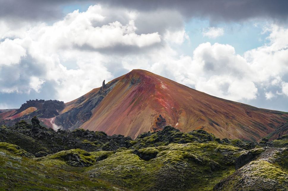
Landmannalaugar mountains. Photo by Gunnar Gaukur Guthmundsson.
Many consider hiking the best way to explore Iceland, as it gives you access to remote sites rarely visited by tour buses. While the glowing rhyolite mountains of Landmannalaugar and glacier-surrounded Fimmvörðuháls are among the best destinations, many other unique hiking trails in Iceland span from East to West. Itineraries range from accessible paths near towns to routes deep in the untouched highlands.
Icelandic Highlands—Pristine and untamed, this mountainous wilderness covers approximately 40% of Iceland, stretching from the central area in all directions. The region is known for moonlike vistas—multi-colored rhyolite mountains, deep craters, and steaming lava fields. Hikers of all levels flock there every summer to explore the famous hiking routes in Landmannalaugar or Fimmvörðuháls. It’s the only region in Iceland for hut-to-hut hiking, though camping is also an option.
Westfjords—One of the oldest parts of the country, the Westfjords, are believed to have formed approximately 16 million years ago. Home to numerous wildlife species, such as white-tailed eagles, arctic foxes, and seals, this part of Iceland is well-known for its exceptional hiking trails. Adventurous off-radar paths in Hornstrandir Nature Reserve are open from June to September, providing an excellent chance to spot wild animals.
Eastfjords—Accessible all year round, the fjords in Eastern Iceland are filled with incredible waterfalls, lush, extensive forests, and a rich history. You can visit the scenic trails of Borgarfjörður Eystri, home to a large puffin colony—approximately 10,000 pairs of these bright-beaked birds nest here from June to August. The eastern region also features Vatnajökull, Europe’s largest glacier, providing various adventurous activities. You can snowmobile, ice cave, and hike on the glacier year-round.
South Iceland—Romantic and raw, southern Iceland is lapped by the North Atlantic Ocean. The region is dotted with volcanic beaches, moss-covered valleys, glacial lagoons, and roaring waterfalls. The southern shore stretches between Reykjavík in the west and Jökulsárlón glacier lagoon in the east and is an all-time favorite among travelers. Here you will find Laugavegur, one of the best hikes in southern Iceland, carving through geothermal springs and obsidian deserts. This path holds a spot among the world’s top-rated routes.
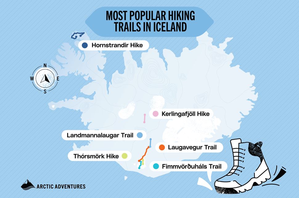
Map of the best hikes to do in Iceland. Source: Arctic Adventures.
One moment, you’re on lava fields; the next, you’re passing a glacier—Iceland’s best hiking spots are full of contrasts. Whether exploring solo or on guided hiking tours in Iceland, trails range from easy day hikes to multi-day treks. While Hornstrandir in the Northwest is a remote alternative, the top routes are in the Southern Highlands.
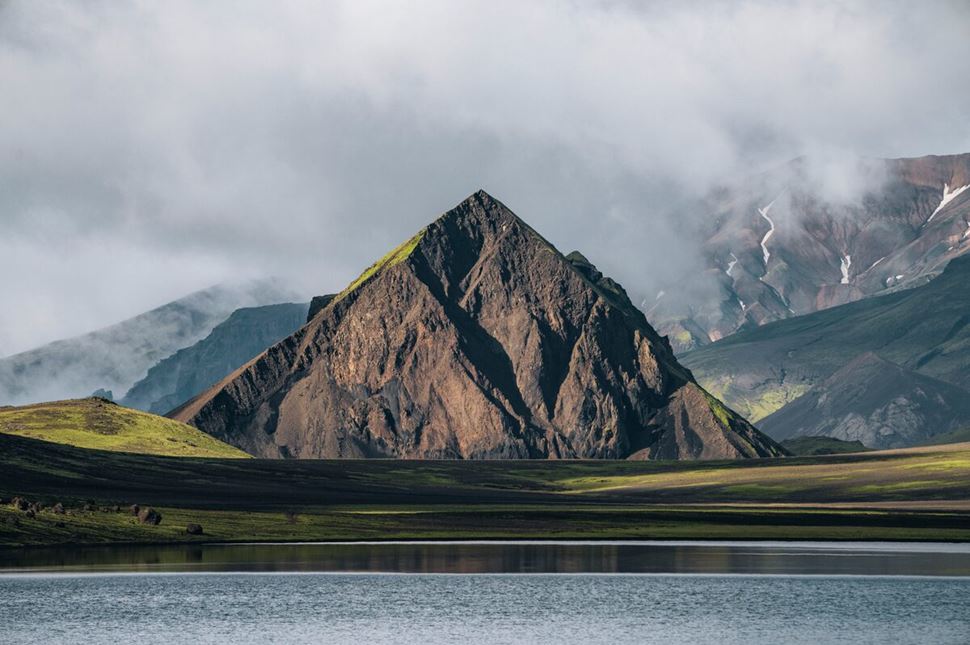
Laugavegur Trek. Photo: Arctic Adventures.
Difficulty: Moderate
Location: Southern Icelandic Highlands
Length: 55 km (34 mi)
Duration: 4–5 days
When to hike: June to September
Book in advance: Laugavegur Hut-to-Hut Trekking Journey
One of the best hiking paths in Iceland, the Laugavegur trail stretches for 55 km (34 mi) and covers top attractions in the country’s Highlands. This scenic route features gems like the black ash desert of Hrafntinnusker, Álftavatn, one of Iceland's most beautiful lakes, and the impressive Mýrdalsjökull Glacier. The trail offers flexible options, from a 3-day backpacking tour to a 6-day itinerary or an extended 8-day trekking trip. With vibrant rhyolite mountains, glacier-carved valleys, and bubbling hot springs, hiking here feels like another planet.
Travelers usually spend the night in the Laugavegur trail huts or tents at the campgrounds. However, the Laugavegur trek is accessible only in summer due to unpredictable weather and challenging winter conditions in the region. You can reach it only using a four-wheel car or a scheduled bus from Reykjavik.
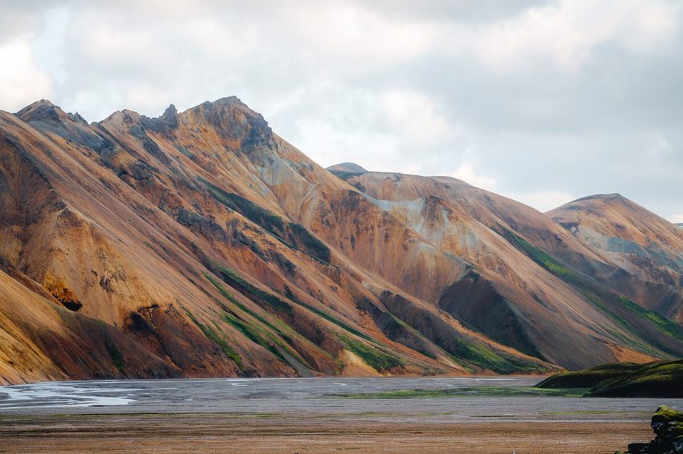
Rhyolite mountains of Landmannalaugar. Captured by Gunnar Gaukur Guthmundsson.
Difficulty: Moderate
Location: Southern Highlands of Iceland
Length: 10–50 km (6.2-31 mi)
Duration: 1–3 days
When to hike: June to September
Book in advance: Landmannalaugar 3-Day Hiking Tour
Landmannalaugar is a world-famous hiking area in the Icelandic Highlands and a part of the Laugavegur trail. This path of moderate difficulty runs mainly through Southern Iceland and features Laugahraun lava fields, Vondugil Canyon, and the rainbow-colored peak of Mt. Brennisteinsalda.
The Landmannalaugar hiking trails are accessible from June to September. Depending on your fitness level, you can go on a single-day or a 3-day trip. During a multi-day trek, sleep in cozy mountain huts or tents at the designated campsites that cost approximately 1800 ISK ($13) per person. You can reach the area in several ways: join a guided tour, take a bus, or take a scenic 3.5-hour drive from Reykjavik.
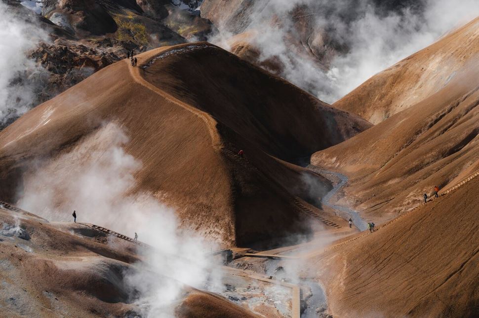
Steam rising from Kerlingarfjöll’s geothermal valleys. Source: Arctic Adventures.
Difficulty: Moderate
Location: Central Highlands of Iceland
Length: 8 km (5 mi)
Duration: 2–3 hours
When to hike: June–September
Book in advance: Kerlingarfjöll hike from Reykjavik
Kerlingafjoll is a mountain range in the Highlands of Iceland, between the Hofsjökull and Langjökull glaciers. Kerlingarfjöll hike is an 8 km (5 mi) trail starting in Ásgarður valley. It includes a visit to the Hveradalir geothermal area and features picturesque rhyolite mountains, colored red and orange by minerals.
Some springs along the Kerlingarfjoll route are suitable for bathing, while you should admire others from a safe distance. It’s best to consult a local guide before approaching the hot pools. Reaching the resort requires a four-wheel-drive vehicle, as the roads are rough and mostly gravel. But once you’re there, the views are like no other place!
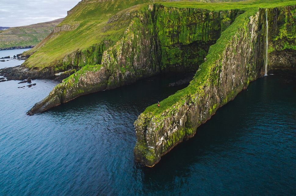
Hornstrandir nature reserve in the Westfjords region.
Difficulty: Challenging
Location: Westfjords of Iceland
Length: 12–60 km (7.5–37 mi)
Duration: 1–6 days
When to hike: June to August
Book in advance: 6-day Hornstrandir Backpacking Trip
Hornstrandir is a Nature Reserve in the Westfjords, covering 580 km² (220 mi²). It’s known for the best off-the-beaten-track paths. This remote hiking area is only accessible from June to September, as it can only be reached by boat or on foot. You’ll rarely meet other people there but may spot some fluffy-tailed arctic foxes.
Hiking Hornstrandir can take anywhere from one to six days, depending on your chosen trail. Wild camping is prohibited, but there are 14 official campsites within the reserve. The solo hike suits intermediate to advanced mountaineers. Positive elevation gain, steep walks down, rough terrain, and strong winds require physical preparation. The reward? Mind-blowing panoramas, wildlife, and solitude.
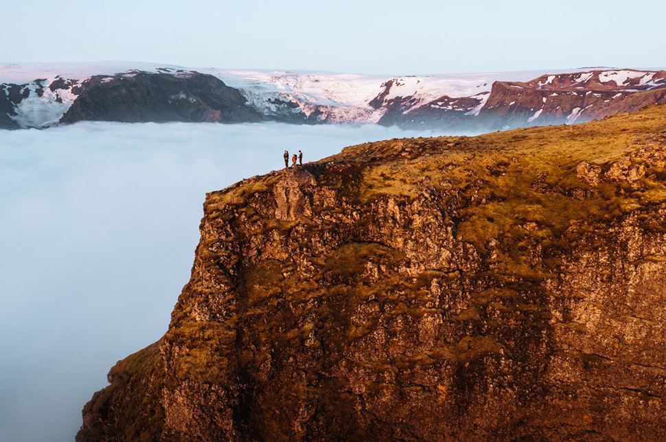
Fimmvörðuháls hike passes between glaciers and volcanoes.
Difficulty: Challenging
Location: Southern Highlands of Iceland
Length: 25 km (15.5 mi)
Duration: 1–2 days
When to hike: June to September
Book in advance: Laugavegur and Fimmvörðuháls Trek
Another well-known route in the Southwest is a pass between two glaciers, Eyjafjallajökull and Mýrdalsjökull. The 25 km (15.5 mi) Fimmvörðuháls route connects the Skógar village on the South Coast with the Þórsmörk valley in the Highlands. The trail goes past the legendary Skógafoss waterfall, follows the Skógá River, and leads to the site of the infamous 2010 Eyjafjallajökull volcanic eruption.
Often paired with the Laugavegur trail, the scenic Fimmvörðuháls hike is one of the best short routes in Iceland, open from June to mid-September. Even in summer, there can be snow along the path, so a pair of sturdy boots and some hiking experience are essential. The maximum elevation reaches 1068 m (3503 ft), adding a challenging but rewarding aspect to the trek.
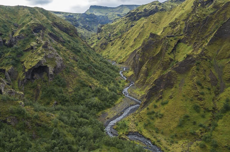
Landscape of Þórsmörk Valley, Iceland.
Difficulty: Moderate
Location: Southern Highlands of Iceland
Length: 8–10 km (5–6.2 mi)
Duration: 3–4 hours
When to hike: All year
Book in advance: Thorsmok Super Jeep & Hike Experience
Þórsmörk is a lush green hiking area nestled between three glaciers in the Southern Highlands known as the Valley of Thor. From mossy cliffs to birch forests, the famous valley is stunning in every season and has a whole network of trails. You can choose from several paths, some leading to the active Eyjafjallajökull, which last erupted in 2010.
Thorsmork volcano hike takes approximately 3–4 hours to complete and reaches an elevation of 800 m (2625 ft). While the trip is of moderate difficulty, getting to the starting point is an adventure in itself. The journey includes rugged terrain and multiple river crossings, best tackled with a 4x4 all-terrain vehicle. The road might experience occasional closures, so check the real-time conditions beforehand.
You don’t need a long holiday to experience Iceland’s scenic trails. Sometimes, just one day is enough—and you don’t even have to go far from the capital. The Reykjavik area is known for Iceland’s best waterfall hikes, leading to magnificent falls, geothermal springs, and vast canyons.
The hike to the second-highest waterfall in Iceland, Glymur, combines beauty and adventure. Located a 30-minute drive from Reykjavik, this moderate-difficulty trail takes around 3 hours to complete, revealing a breathtaking 198 m (650 feet) cascade.
This picturesque trail takes you on a one-hour hike through the Reykjadalur Valley hot springs, bubbling mud pools, and a natural hot river for bathing. Located near the town of Hveragerði, this 3.4 km (2.17 mi) path is best accessed by car.
Not far from the town of Borgarnes, Borgarfjörður is a stunning fjord in West Iceland. More than 20 hiking paths wind through volcanic fields and geothermal pools—approximately an hour from the capital. Most routes take 1-6 hours to complete.
The easy, one-hour Stuðlagil Canyon hike is an 8 km (5 mi) out-and-back trail. Its dirt and gravel path is mostly flat but slightly uneven. This route leads to stunning basalt columns in East Iceland, 597 km (371 mi) from Reykjavík.
The hiking trail to Svartifoss waterfall is in the Skaftafell Nature Reserve, 141 km (87.6 mi) from the village of Vík. The easy hike is approximately 1.5 km (1 mi) long, leading to the stunning 20-meter (66-foot) waterfall.
The route to Skógafoss is near the river Skógá in southern Iceland. The 8 km (5 mi) Skogafoss hike—leading to one of the best waterfalls in Iceland—requires some physical preparation, as it involves climbing a steep hill.
Seljalandsfoss waterfall trail on the South Coast, approximately 120 km (74,5 mi) from Reykjavík, is one of the country's most unique waterfall walking paths. A 30-minute hike leads to the falls and, in summertime, behind the mighty cascade.
Öxarárfoss waterfall hike takes you to a Game of Thrones filming location. The 13 m (44 ft) high falls are located inside Thingvellir National Park on the Golden Circle route.
Waterfall trail that follows the river Jökulsá, fed by the Vatnajökull glacier, which drops 600 m (1,968 ft) over a 30 km (18.6 mi) stretch, creating a chain of at least 15 waterfalls. Start your hike at the Wilderness Center and explore Iceland's wild nature on this guided multi-waterfall tour.
Iceland is one of the few places where you can hike through lava fields and craters and even reach active volcanic areas. A volcano hike in Iceland is a rare chance to experience nature’s power up close, with some top trails not far from the capital.
Reykjanes volcano trail—A hiking path that presents a rare opportunity to see the newly formed lava fields on Iceland’s Reykjanes Peninsula. The 5–6 hour walk of moderate difficulty reveals striking geological changes caused by the eruptions of the Fagradalsfjall, Sundhnúkur, and Meradalir volcanoes.
Eyjafjallajökull hike—A 12-km (7.4 mi) out-and-back trail leads to Eyjafjallajökull, one of the few stratovolcanoes in Iceland. Covered by an ice cap, the volcano awakens every 200 years—the last eruption was on March 20, 2010. This challenging route rewards with stunning views.
Askja volcanic crater hike—A short 30-minute walk that takes you to a volcanic crater in the highlands known as the Askja Caldera. Hike along the caldera's rim, where you can see the serene blue water of the crater lake, Víti, or just relax and enjoy the surroundings.
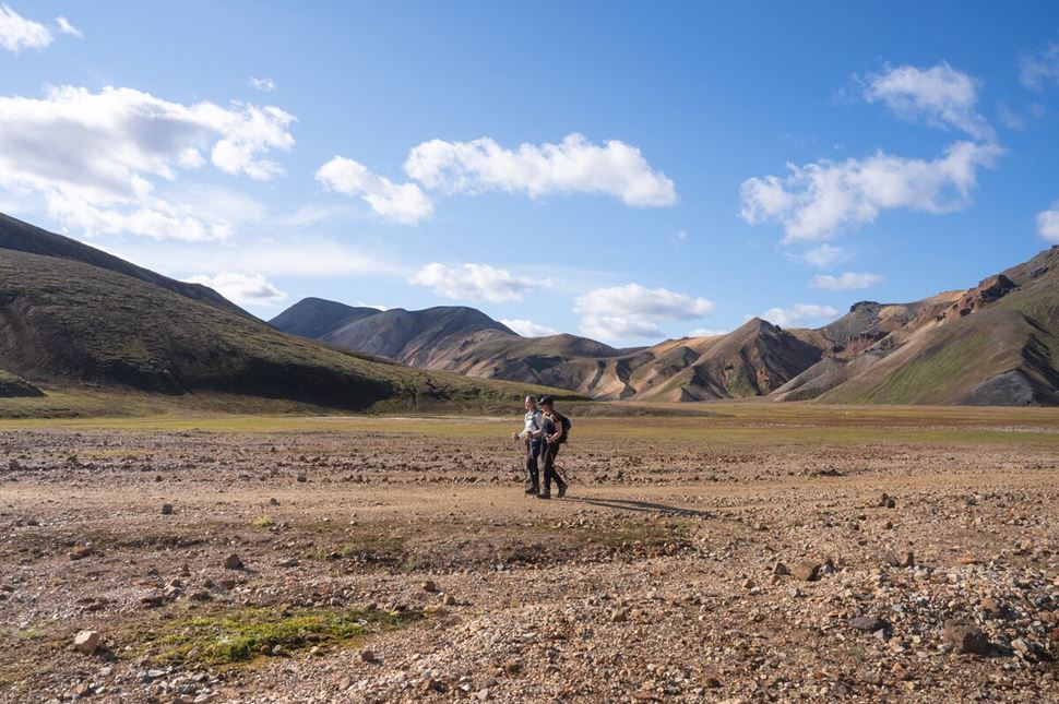
Iceland’s Highlands are best explored in summer. Photo by Bessi Friðþjófsson.
The best time for hiking is from June to mid-September when the weather is warmest, Highland roads are open, and the midnight sun extends daylight hours. Iceland's spring and autumn usually have unpredictable conditions, but many routes remain accessible. In winter, most trails close, though glacier hikes are typically possible year-round with an experienced guide. To find the best route, consider climate conditions in each season.
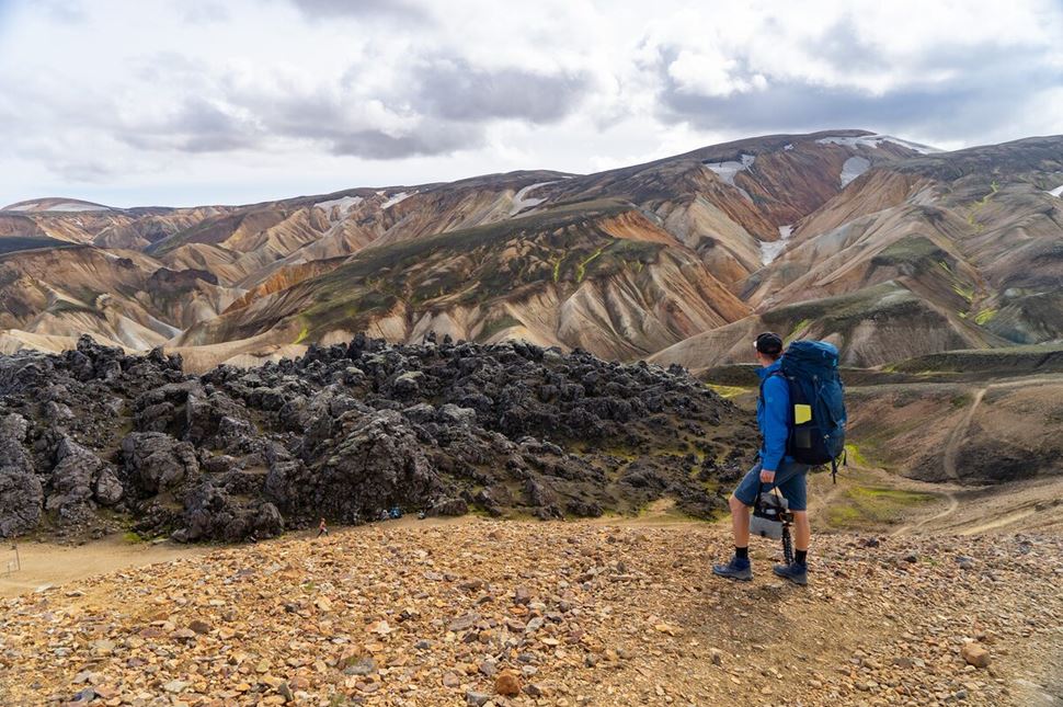
Dress for every season on Iceland’s trails.
Hiking in Iceland requires careful planning due to unpredictable weather and isolated terrain. Choose trails that match your fitness level, with well-marked routes recommended for beginners. Check forecasts before heading out, as conditions can shift quickly. Preparation when hiking is extremely important—proper gear and footwear ensure safety on the trail.
When going hiking and trekking, regardless of how many days you are going for, it is always good to plan your Icelandic gear packing in advance. It’s important to bring all the things you need but not all the things you want, as unnecessary weight can hold you back and make the route more strenuous.
Clothing: Waterproof, layerable garments (base, mid, and shell) made from quick-drying, moisture-wicking materials such as synthetic, wool, or merino.
Footwear: Sturdy, waterproof hiking shoes with ankle support.
Other essentials: GPS, a dry bag to protect your electronics from rain, sunscreen, sunglasses, toilet paper, and a portable battery.
Iceland is one of Europe’s top hiking destinations, with trails passing through lava fields, geothermal valleys, black sand deserts, and glaciers—sometimes all in one day. However, most routes are only accessible in summer. Certain multi-day treks have huts and clear signs for easier navigation.
Iceland has a variety of great hiking trails, including well-known routes like Laugavegur and more remote paths like Hornstrandir. Additionally, there are around 200 campsites and 40 mountain huts. Iceland’s hiking infrastructure provides essential facilities for trekkers.
The Laugavegur Trail is Iceland's most famous and beautiful hiking route, stretching 55 km (34 miles) through the Fjallabak Nature Reserve. It’s known for its rainbow-colored rhyolite mountains, black sand deserts, steaming hot springs, and glacier views, offering unmatched scenic variety. The trail is moderate in difficulty, open from late June to early September, with options for hut-to-hut trekking or camping. Its diverse landscapes and dramatic contrasts make it Iceland’s most breathtaking long-distance hike.
You need basic fitness and stamina for hiking in Iceland, as trails vary from easy walks to demanding multi-day treks. Family-friendly routes like Öxarárfoss (1.2 km / 0.75 miles) take about 15–20 minutes, while challenging hikes like Laugavegur require daily hikes of 11–18 km (6.8–11.2 miles). You’ll find a variety of trails for all difficulty levels in Iceland, accessible to both casual walkers and experienced hikers.
July is one of the best months for hiking in Iceland, with the warmest temperatures of the year (10–15°C / 50–59°F) and nearly endless daylight. Hiking in Iceland in July is ideal since prime trails like Laugavegur and Fimmvörðuháls are fully open. However, expect bigger crowds and higher accommodation prices than in other months. In June and from August to mid-September, you may find fewer people on the trails.
Even though Fimmvörðuháls is only 25 km (15.5 miles) long, it’s considered challenging due to its steep ascents, rough terrain, and frozen patches. The trail crosses glaciers and volcanic ridges, with a significant elevation gain of over 1,000 meters (3,280 feet). While the path is marked with stakes, parts of the trail are often covered in snow or ice, making navigation more difficult.
Hiking in Iceland without a guide is possible, but it’s not recommended in certain areas like glaciers or remote regions like Westfjords. Most day hikes, such as those near Reykjavik, can be done with minimal experience and preparation. Multi-day treks like Laugavegur require a higher level of expertise, as they involve challenging terrain. If hiking alone, assess your skills realistically, ensure you’re well-prepared, and familiarize yourself with the route.
You can only wear sneakers for hiking in Iceland if your trail is on a dry, paved path and does not exceed 1–2 km (0.6–1.2 mi). Sneakers lack grip, waterproofing, and ankle support, making them unsafe for Iceland’s rocky, uneven, and often slippery terrain. For longer hikes or any trail with elevation, loose gravel, or wet conditions, waterproof hiking boots or sturdy trail shoes are a must.
The easiest hikes in Iceland are short, single-day trips close to the capital, Reykjavik. A hike to Öxarárfoss waterfall in Thingvellir National Park is a good option if you’re looking for a trail to complete in an hour. Another easy 1.5 km (1 mi) trail is to the Svartifoss Waterfall in Skaftafell Nature Reserve, where the route is mostly flat and doable for beginners.
The famous Laugavegur trail is moderately difficult, covering 55 km (34 miles) in 4–6 days. The route includes varied terrain, such as volcanic deserts and steep climbs. You need to be in good physical condition and have solid hiking experience. While accessible to experienced hikers, it’s unsuitable for visitors arriving without hiking knowledge.
You can reach the Laugavegur Trail in Iceland by highland bus or a 4x4 (4WD) rental car from Reykjavík to Landmannalaugar, the trail’s starting point. The drive takes 3–4 hours, as F-roads are unpaved and rough and may require river crossings. Highland buses are private, seasonal services operating in summer for those without a 4WD vehicle. All transfers are pre-arranged and included if you’re joining our Laugavegur trek.
As of 2025, the Laugavegur Trail is Iceland's longest officially marked hiking trail, stretching 54 km (34 miles). Some hikers extend their journey by adding the Fimmvörðuháls Trail to Skógar, creating a popular but unofficial 79 km (49 miles) route. While sources previously mentioned the Reykjavegur Trail as Iceland’s longest hike at 127 km (79 miles), multiple volcanic eruptions in the Reykjanes Peninsula have likely made it impassable. Other long-distance hikes exist but often combine established trails rather than a single marked route.
Mount Esja is the best mountain near Reykjavík due to its proximity (10 km / 6 miles), well-marked trails, and panoramic city views. The hike is 6.2 km (3.9 miles) round trip, takes 2–3 hours, and gains 575 m (1,886 ft) in elevation. Many hikers ascend via an easier path and descend a steeper route, creating a loop. The trail is moderate to challenging and should be hiked in summer, as winter conditions can make it icy and risky without proper gear.
It is free to hike in Icelandic nature. Although, if you plan on hiking for several days, keep in mind that wild camping is prohibited. You can choose to stay at designated campsites or huts, which require a fee.
You can hike freely in Iceland on uncultivated land, following the traditional "freedom to roam" principle. Be mindful of private property, cultivated fields, or fenced areas. Hikers must stay on marked trails in national parks and protected areas, and wild camping is not allowed. Always check local restrictions in Iceland before your trip.
The Fagradalsfjall Volcano Route is a moderately difficult 7.4 km (4.6 mi) trail with 476 m (1,562 ft) of elevation gain, taking around 3 hours to complete. It passes through lava fields from the 2021 eruption, with steep sections and rough terrain. Due to ongoing volcanic activity and eruptions in late 2024, conditions can change quickly, posing risks from toxic gases and unstable ground. Hiking with a local guide is strongly recommended for safety.
You can reach Landmannalaugar from Reykjavík with a four-wheel drive (4WD or 4x4) vehicle, highland bus, or tour transfer. The area is only accessible via F-roads, which are unpaved, rocky, and often require river crossings. Highland buses are private seasonal services, not public transport, operating in summer because standard vehicles cannot handle these roads. On our tours to Landmannalaugar, all transfers are organized in advance.
Volcano hikes in Iceland are generally difficult due to steep climbs, rugged terrain, and shifting weather. Hekla volcano takes around 4 to 6 hours and has a steep ascent. Eyjafjallajökull is a 10 to 12-hour demanding glacier hike, but Askja is much easier—just a 30-minute walk from the parking area to the crater. Some hikes, like Fagradalsfjall, are shorter but still challenging due to unstable ground and potential volcanic activity. Always check weather alerts and trail conditions, and consider hiking with a local guide for safety.