Spring is the best-value time to explore Iceland View Deals
The Snaefellsnes Peninsula – or “Iceland in Miniature” – is a geological wonderland in West Iceland with vast, spectacular views reaching over mountains, lava fields, and empty roads. Driving along the peninsula, you can visit charming Danish-influenced fishing villages, the most photographed mountain, Kirkjufell, and other extraordinary sights!
Iceland has 13 peninsulas, but the Snæfellsnes is exceptional - the country's largest, stretching over 56 mi (90 km). It is celebrated for its sensational landscapes, geology, and shockingly beautiful scenery.
The area features many of Iceland's famous natural attractions, including active and dormant volcanoes, basalt cliffs, and expansive lava fields. The Peninsula is often referred to as “Little Iceland,” “Iceland in a nutshell,” or “Miniature Iceland.”
There are numerous ways to explore those natural wonders. You can rent a car and self-drive or book one of many award-winning Snaefellsnes tours. Experienced guides will take you to all the best destinations!
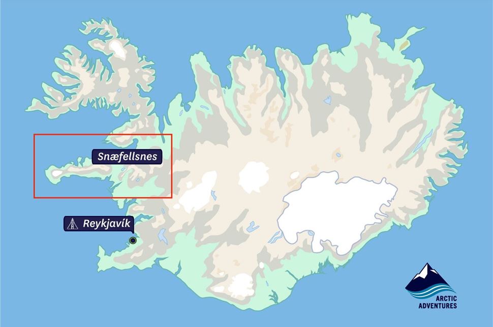
Location of Snaefellsnes in Iceland. Source: Arctic Adventures.
This narrow cape is located on Iceland's western coast, between the Reykjanes Peninsula (the one near Reykjavik) and the Westfjords.
Here are the distances of some of Snæfellsnes key locations from the capital and other popular tourist areas:
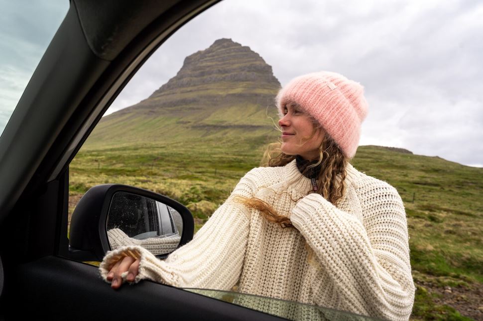
Driving past the iconic hill in Iceland - Kirkjufell. Photo by Bessi Gautur Fridthjofsson.
Exploring the headland by car is an excellent choice for those who want to fully immerse themselves in the surrounding beauty, make frequent stops, and take their time.
For a deeper exploration, give yourself two to three days. Aim for 10-12 hours to see the highlights if you're just doing a day trip.
Renting a car in Iceland is straightforward and commonly practiced. A standard vehicle will do when road conditions are generally good in summer. However, a 4x4 vehicle is advisable during harsher weather conditions.
Remember to always check the road conditions in Iceland before starting a self-drive journey.
Interesting fact: If the weather is perfect, driving the entire peninsula takes about two hours without stopping.
However, if you want to take the worry out of planning your own transportation and enjoy Iceland's beauty to the fullest, join a private tour of Snaefellsnes combined with other popular regions, the South Coast and Jokulsarlon.
There are so many different options for visiting the Iceland Peninsula. You can take a public bus to the region or easily rent a car and drive!
The Snæfellsnes is well-connected by several vital roads:
The famous peninsula is approximately 85 miles (136 kilometers) away from the capital.
Driving from Reykjavík should take about 1.5 - 2 hours. For the most part, just follow the Ring Road (Route 1) through Mosfellsbær town, into Borgarfjörður Valley, and the town of Borgarnes.
At the last roundabout, you’ll make a left onto Road 54. This road will take you well into the headland.
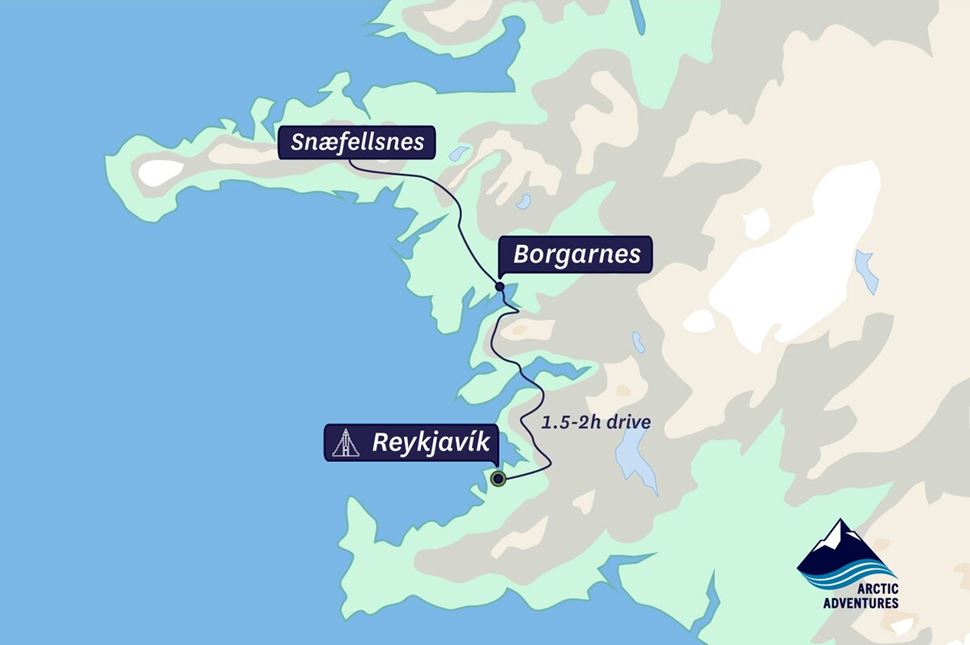
Reykjavik to Snaefellsnes route. Source: Arctic Adventures.
Driving from the city of Akureyri - the capital of North Iceland should take about 4.5 - 5 hours. The trip covers a distance of approximately 230 miles (370 kilometers).
Again, you need to mainly follow Route 1 (the Ring Road). The drive will take you to Snæfellsnesvegur Route in the town of Borgarnes. You will turn off for Road 54 on the roundabout and continue to your destination.
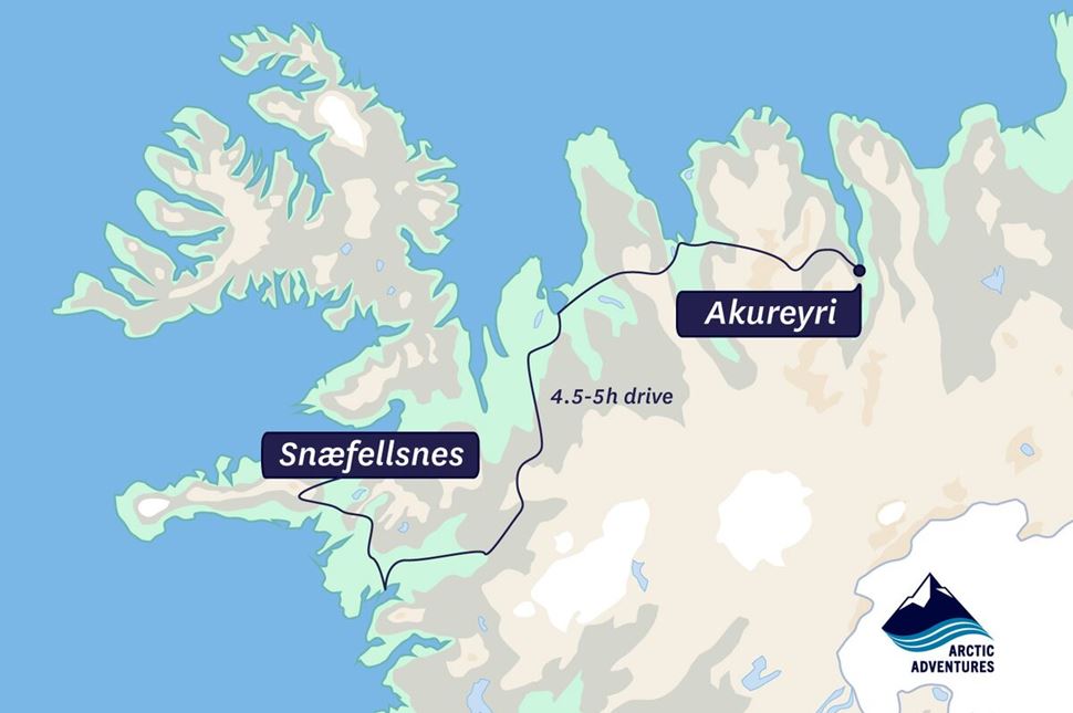
Road to Peninsula from Akureyri. Source: Arctic Adventures
From dramatic mountains to small charming towns, the cape is a perfect mix of natural wonders and thrilling activities. The area is famous for great hiking spots, lava-caving, and wildlife-watching opportunities. Whenever you go, you’ll find plenty of attractions to enjoy.
Some of the top Snaefellsnes destinations and most popular highlights include:
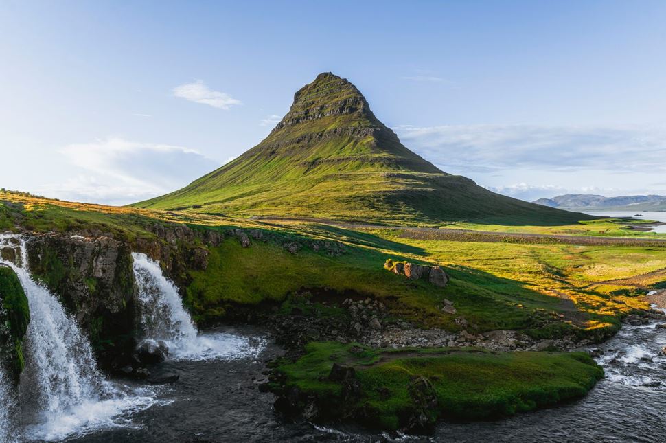
Mt. Kirkjufell, known as the "Witch’s Hat," has a beautiful waterfall nearby. Source: Arctic Adventures.
The picturesque mountain is a 1519-foot (463 m) peak that rises high above the fishing village of Grundarfjörður. Many say it resembles a church steeple or a witch’s hat, sharpened at the top with long curved sides.
Mt. Kirkjufell has been listed as one of the 25 most beautiful mountains in the world. No surprise! Its perfect coastal location and dramatic appearance attract many photography enthusiasts from all over the globe.
Explore the breathtaking views by kayaking under Kirkjufell at midnight or hiking a steep trail to the top.
Note: Hiking on the mountain is only allowed during the summer months and requires a lot of experience and preparation.
The western part of the peninsula is home to the famous Snæfellsjökull National Park, whose main attraction is Snæfellsjökull — a striking volcano covered in ice rising 4,744 feet (1,446 meters). It last erupted about 1,800 years ago, yet it is still considered active. Its glacier-covered peak is a very popular site. Around the glacier, you can explore volcanic features like craters and lava tubes.
The renowned park is one of the country's three national parks, known for its black-sand beaches, lava tube systems, and volcanic craters.
It was established in 2001 and was named after the glacier-capped Snæfellsjökull stratovolcano (a volcano built up by numerous layers of hardened lava).
It is located on the west tip of the peninsula and can be visited throughout the year. Try glacier hiking or take a snowcat ride to the top of Snæfellsjökull Glacier!
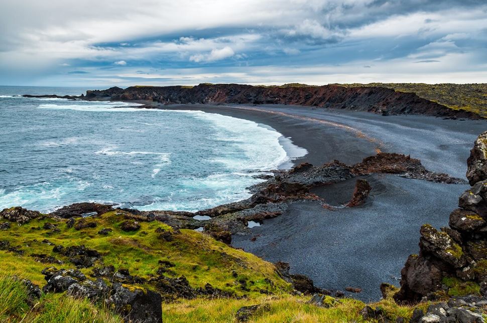
Panoramic view of Djúpalónssandur Beach in Iceland.
At the tip of the Snæfellsnes peninsula is Djúpalónssandur, a black sand beach with small, smooth pebbles. Djúpalónssandur is one of the most beautiful beaches in Iceland, known for its unique "Pearls of Djúpalón"— dark, rounded rocks that make the beach stand out.
Interesting fact: the pebbles on this beach are protected, so while you can take pictures, please don’t pick them up.
One surprise you can find on the coast is the Dritvík Lifting Stones. These boulders, used historically to test the strength of fishermen, range from 50 lb (23 kg) to 339 lb (154 kg). To qualify for a position on a fishing boat, crew members needed to lift these stones onto a platform. The heavier the stone they could lift, the higher their rank and salary on the ship would be.
Shipwrecks are also a part of this beach’s history. Rusty metal from the 1948 wreck of the British trawler Epine GY7 and other ships like the ÁSA from 1925 can be found scattered along the shore. Be careful not to touch any metal fragments.
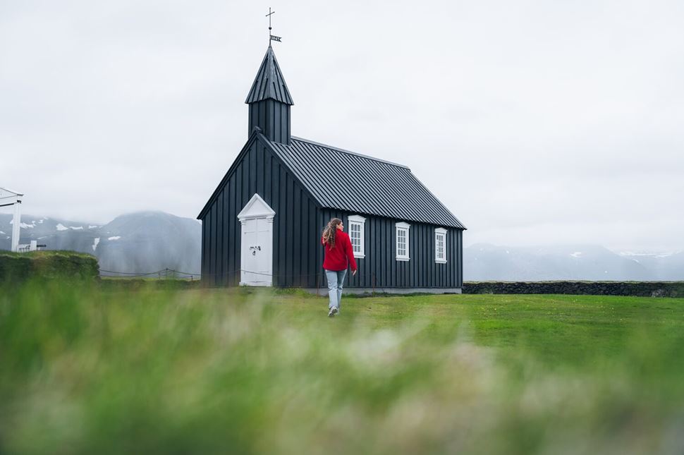
Búðakirkja - a historic wooden church. Photo by Gunnar Gaukur Guthmundsson
Búðakirkja is one of the most photographed churches in Iceland. It is located on the peninsula's south side. This tiny wooden church was built in 1848, and its design is typical of old Icelandic churches.
The site attracts many photography enthusiasts from all over the world. Its dark appearance contrasts with the vibrant colors of nature, creating an epic picture.
Many visitors feel a special energy around this place, suggesting it might be a truly magical location. But this is something you'll have to discover for yourself!
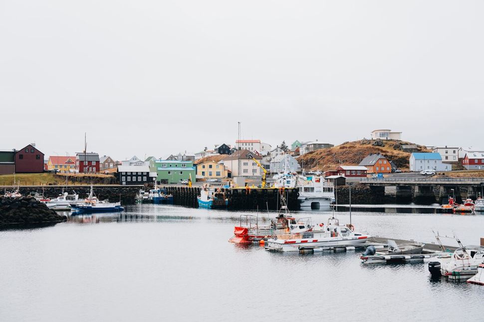
Harbor in Stykkishólmur, the largest town on the peninsula. Source: Arctic Adventures
Stykkisholmur is a charming fishing town on the northernmost tip of the Snaefellsnes Peninsula. It is well-known for its colorful boats, old-style houses, and many exciting activities.
Experience the sea kayaking tour from Stykkisholmur, where you can view stunning cliffs and even spot puffins, seals, and whales!
Vast lava fields and open spaces surround this cozy town. Combined with minimal light pollution, it makes a perfect setup for Northern Lights. A short walk outside Stykkishólmur can lead you to the perfect Aurora spotting location.
After an exciting day, relax in the town’s naturally warm and mineral-rich swimming pool.
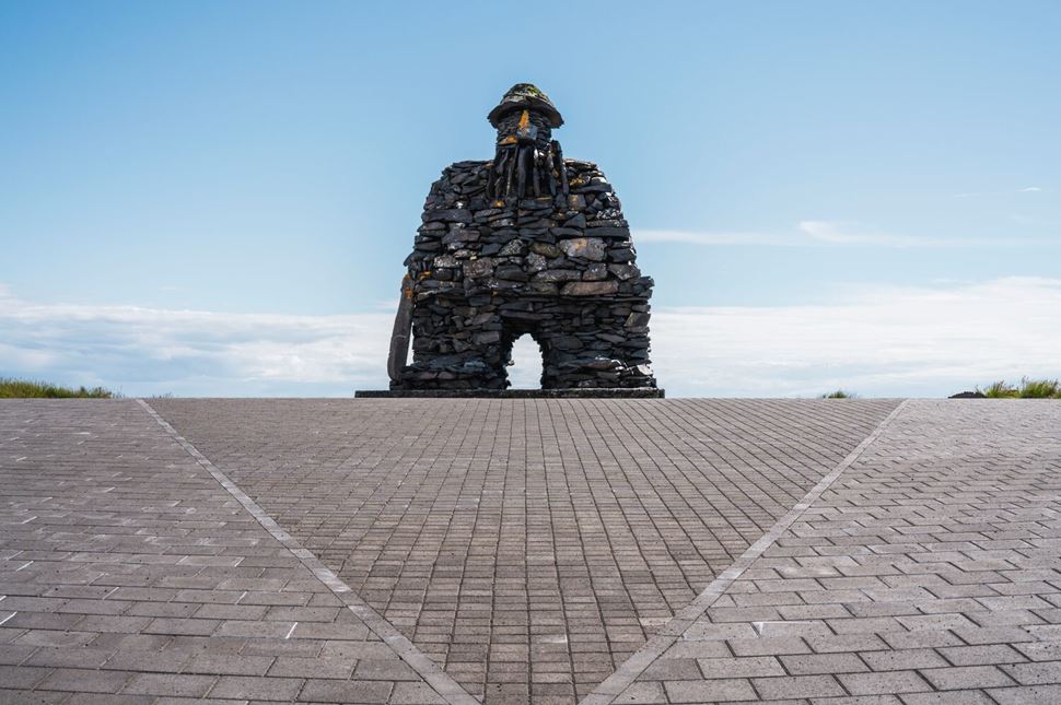
Statue of the saga character Bardur Snaefellsnes. Source: Arctic Adventures.
Arnastrapi is another serene village on the southern side of Iceland’s Snaefellsnes Peninsula.
The fishing village holds a special place in Icelandic folklore. The sagas often mention a mysterious character known as Bárður Snæfellsás, half-ogre, half-human.
According to the legends, Bardur lived and protected the area. The names of many places around Arnastrapi are inspired by stories about this mythical character.
You won’t get bored in Arnastrapi, as many activities exist. You can visit the favored Bárður statue, hike to the famous Gatklettur Stone Arch, or go on a lava-caving tour!
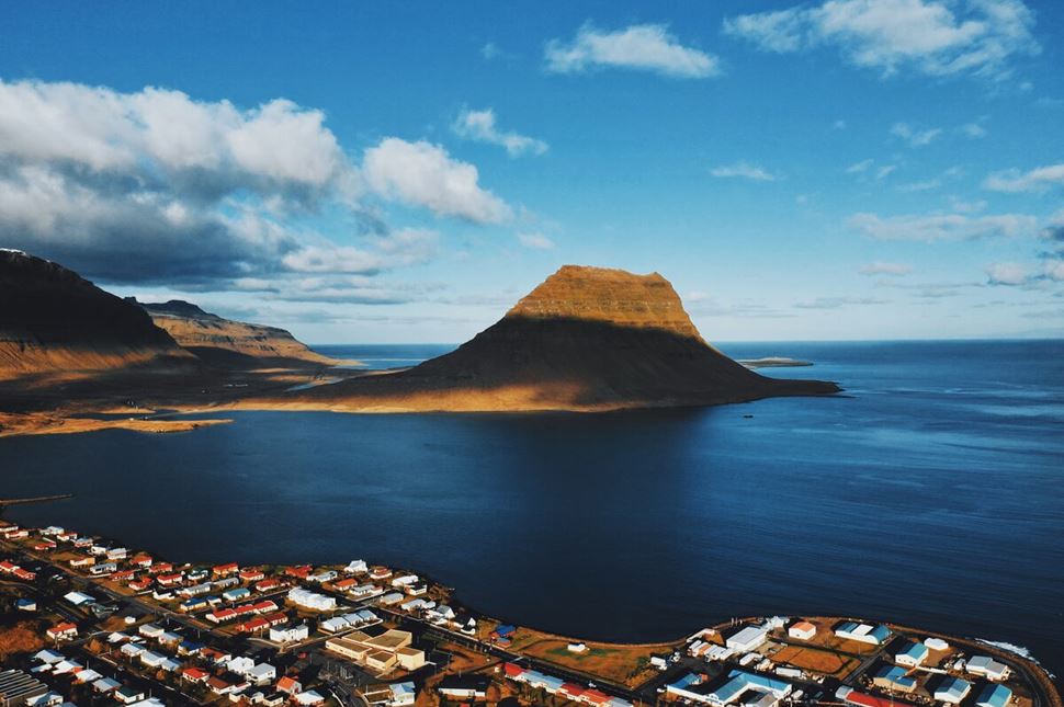
The fishing town Grundarfjörður sits right below the mountain range.
Grundarfjordur settlement, sitting under Kirkjufell Mountain, is a lovely small village with colorful houses and an authentic appearance. Surrounded by mountains, it is a perfect location for hiking and horse riding tours.
It’s a small town, but you can actually do so much there! First, you can enjoy the views of magnificent Kirkjufell and Kirkjufellsfoss (its neighboring waterfall) from several viewing points.
Other attractions include kayaking under Mt. Kirkjufell, whale-watching, swimming in the local swimming pool, and visiting the shark museum!
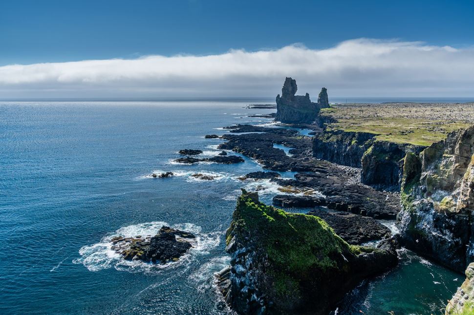
Londrangar, the 'Rocky Castle,' are basalt towers on the Atlantic coast.
The Londrangar Basalt Cliffs are one of Iceland's most impressive geological wonders. Two uniquely formed volcanic plugs (hardened remains of active volcanoes) protrude from the shore and can be seen from afar. One of the pillars is approximately 233 ft (71 m), and the other is approximately 200 ft (61 m).
Like other basalt formations in Iceland, Lóndrangar has local legends, so farmers avoided it due to the belief that elves live in the rocks. Nearby, there’s a cliff where a poet once made a deal with the devil. The landscape may seem simple, but it’s beautiful, with puffins and fulmars nesting on the high cliffs in summer.
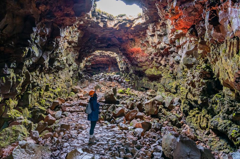
It’s possible to step inside the 8,000-year-old Vatnshellir lava tube.
Vatnshellir Cave is located approximately 10 minutes (drive) from the village of Hellnar, between Lóndrangar Cliffs and Djúpalónssandur Beach.
This natural wonder is a true representation of the volcanic activity on this Viking island. The lava tube formed thousands of years ago as a result of a volcanic eruption.
Lava caves form when the outer stream of flowing lava slowly cools down and develops a crust. The inner stream continues to flow and creates a tunnel. The fascinating part is that you can actually step inside this underground cave - but only on guided tours.
There is a staircase in Vatnshellir that leads into it. The walls inside the cave are naturally colored by the minerals and look truly spectacular!
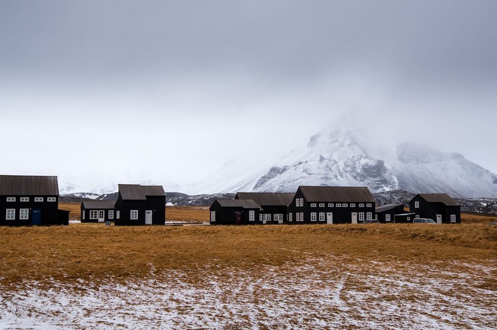
Hellnar is an old fishing village on the far west of the Snæfellsnes Peninsula.
The ancient fishing village of Hellnar once was the largest fishing station on the Snaefellsnes.
As Iceland industrialized, Hellnar lost its significance. However, it has become a great place to experience the country’s culture and history, attracting many travelers.
The village has many lovely accommodation options to experience an authentic stay. When walking in the area, you’ll spot some well-maintained Icelandic farms, a historical church, and an interesting exhibition about the economy of the older times.
Enjoy Hellnar's countryside beauty, learn Icelandic history, enjoy picturesque views all around the village, and try local cuisine!
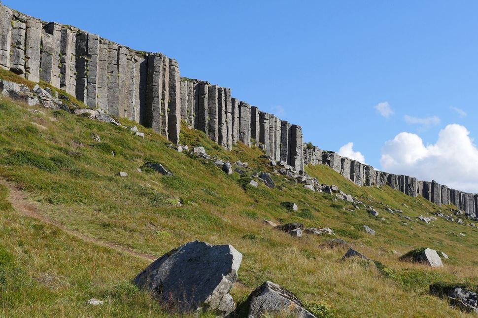
Impressive view of a half-kilometer of neatly stacked basalt columns.
On the southern side of the peninsula, you’ll find iconic Gerðuberg cliffs - symmetrical basalt formations that look like they’ve been hand-carved!
Unique, magnificent, and mysterious are the words to describe them. Precisely symmetrical columns look like they’ve been hand-carved by the giants. But don’t be mistaken. It’s another byproduct of the island’s volcanic activity.
Basalt cliffs, measuring up to 46 ft (14 m) tall and 6.5 ft (2 m) wide, represent nature's artistry. After the volcanic eruption thousands of years ago, the flowing lava ran off the cliffs and met the cold water of the sea. As a result, it hardened, formatting uniquely shaped pillars.
To best enjoy the cliffs' views, walk along the path alongside the structures.
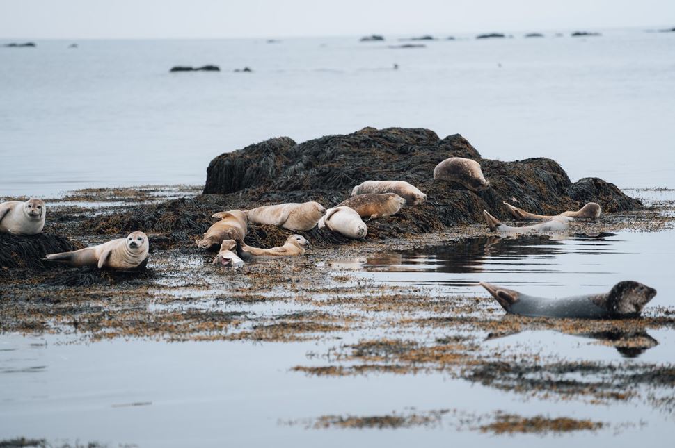
Cute seals relaxing on the Ytri-Tunga Beach. Source: Arctic Adventures.
Ytri-Tunga Beach is nested on the southern coast of the Snaefellsnes Peninsula. Unlike most Snaefellsnes beaches, this one has beautiful golden sand rather than black.
Magnificent Ytri-Tunga Beach is one of Iceland's best places to spot seals. The most common seals species in Iceland are grey seals and harbor seals.
You’ll find those precious animals lurking around the shore throughout the year. Remember, keeping a safe 164 ft (50 m) distance from the seal colony is recommended.
Don’t forget your camera if you plan to visit Ytri-Tunga Beach! You'll want to capture the beauty of the golden sands framed by wild grasses and dunes - and, of course, the adorable faces of the seals!
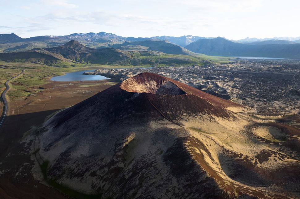
Extinct volcano in the Berserkjahraun lava fields. Photo by Gunnar Gaukur Guthmundsson.
Iceland is called a volcanic island for a good reason. Countless volcanic eruptions formed the landscape of this unique country, and the lava fields are perfect evidence of it.
Situated north of Snaefellsnes, a 4000-year-old Berserkjahraun lava field is full of volcanic rock formations, moss-covered rocks, and abundant wildlife. In this vibrant and contrasting region, you can sometimes spot various species of birds, rabbits, and even arctic foxes.
Moreover, the area is full of local legends and myths. The most popular one tells a dramatic story of two Swedish Berserkers (warriors).
Apart from exploring the lava formations, the area is also popular for hiking trails and great landscapes for photography.
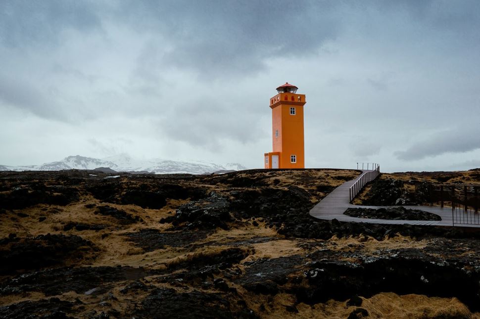
It’s hard to miss the bright orange Svörtuloft Lighthouse.
For those seeking picturesque views, Svörtuloft Lighthouse is the perfect place. Its bright orange color stands out strikingly against the black lava cliffs and blue sky - a perfect scene for an Instagram photo!
One of the highlights in the area is birdwatching. The viewing platform offers an excellent spot for observing various seabirds flying around the cliff. The best months for this activity are between May and August.
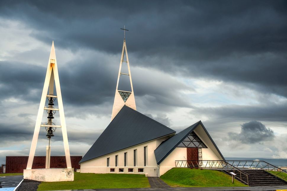
Ólafsvíkurkirkja - a modern Lutheran church.
The beautiful town of Ólafsvík, lying on the northwest side of the headland, is one of the main sources of Iceland’s fishing industry.
The beautiful modern church of the town stands out from the other buildings in the country and draws the attention of many visitors. Its triangular design looks like a fishing boat and symbolizes the trinity in Christianity.
Another town attraction is the Pakkhus Folk Museum. The shop on the ground floor sells local handicrafts and lovely gifts.
Ólafsvík is also one of the best places for whale-watching. If you are interested in spotting those magnificent sea creatures, join a whale-watching tour and maximize your chances of seeing one with your own eyes!
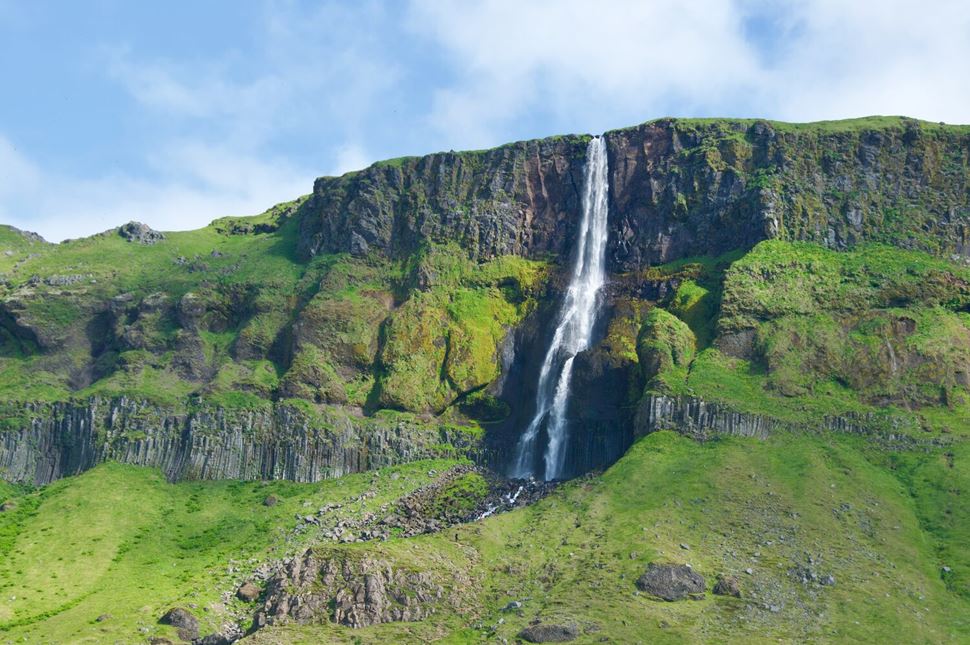
Bjarnarfoss is visible from Road 54 as you drive around the peninsula.
The legendary “lady of the mountain” Bjarnafoss, surrounded by incredible basalt cliffs, is a two-tiered waterfall measuring 262 ft (80 m) in total.
Its steep cascade drops down the sharp volcanic rocks, and visitors can admire the falls' power by getting close to them.
Legends say that underneath the waterfall stood the “Lady of the Mountains,” called Fjallkonan, and the water from the falls would drop onto her shoulders.
The lady represents the Icelandic people and is considered a powerful symbol of the country.
Since there are so many towns and villages on this famous landform, you’ll definitely find a place to stay in the area.
Choose from hotels, guesthouses, cabins, and cottages. Also, if you’re wondering where to camp in Snaefellsnes, you’ll be pleasantly surprised - there are many nice campgrounds to be discovered!
Hotels
Guesthouses
Campsites
The diverse peninsula is known not only for its abundant wildlife and serene landscapes but also as a place of historical and cultural significance. You’ll find many great places to try some traditional Icelandic dishes, as each region has something special to offer.
If you want to discover more, read our detailed article about the best places to eat in Snæfellsnes.
The weather on the Snaefellsnes Peninsula is similar to the rest of the island - changing and unpredictable, yet perfectly reflecting this unique country's charm.
In summer - mild weather, endless daylight, and good road conditions. On average, summer temperatures on the headland range between 47 and 56°F (8 to 13°C).
In winter - it gets colder but not extremely so. You’ll need to wear warmer winter clothes, but temperatures usually range from 27 to 36°F (-3°C to 2°C).
Keep the peninsula’s weather in mind as you plan your trip.
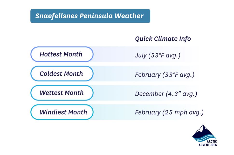
Peninsula’s climate averages. Source: https://www.timeanddate.com/
About 1-2 million years ago, volcanic activity began beneath the ice, leading to the formation of mountains made of volcanic rock fragments and striking lava and ash craters. Then, around 12,000 years ago, during the end of the last ice age, massive glaciers covered the peninsula.
As the glaciers moved, they wore down the mountain peaks by scraping and grinding them. This process, called glacial erosion, shaped mountains over time.
Before gaining global fame, Snæfellsnes was mentioned in the Icelandic Bárðar Saga. It was presumably written in the 13th or 14th century.
Its international spotlight came in 1864 when Jules Verne chose Snæfellsjökull as the fictional gateway to the center of the Earth in his novel Journey to the Center of the Earth.
Iceland is known to be a trendy filming location. Its picturesque views and dramatic landscapes surpass anything that could be created with a green screen. Many films, TV Shows, and even music videos were filmed here, and some of the best-known are:
The main star, Ben Stiller, was inspired by this country and shared his thoughts in an interview:
There's so much more to see and do in this unique Icelandic headland - a place you'll never forget! If you'd like to delve even deeper into this region, have a look at our detailed guide to the best things to see and do in Snæfellsnes.
The Snaefellsnes is pronounced as ‘snay-fells-nes.’ In Icelandic, this name means “Snow Mountain Peninsula,” named after the glacier-capped Snæfellsjökull volcano.
For a thorough visit to Snæfellsnes Peninsula, plan for about 12 hours to see all the sights in a day. If you want to explore more comfortably, extending your visit by over two to three days is best.
The cape stretches about 55 miles (90 kilometers) into the Atlantic Ocean, starting from Borgarnes town and reaching the Snæfellsjökull volcano at its western tip. This narrow strip of land varies between 6 to 12 miles (10 to 20 kilometers) in width.
Snaefellsnes has a population of 3,900. They mostly live in five fishing villages and on nearby farms, which are divided among five municipalities.
Camping on Snæfellsnes is allowed, but only at designated sites. The harbor town of Stykkishólmur has many pitches for tents and a service building with showers and washrooms. However, camping in Snæfellsjökull National Park is not allowed.
You can visit Snaefellsnes Peninsula year-round. However, depending on your activities, you may want to choose to travel in particular months. May and August are best for puffin-watching, July and September for hiking on glaciers, and September and April are best for seeing the Northern Lights.
There is no entrance fee to Snaefellsnes National Park. Some additional activities inside the park, such as exploring Vatnshellir Cave, require a guided tour and are therefore priced accordingly.
The Snaefellsnes National Park has many natural wonders, including the impressive Snæfellsjökull glacier. Some of the remarkable sites include: