Spring is the best-value time to explore Iceland View Deals
The 269 glaciers in Iceland, which cover about 4,400 square miles (11,400 km²), dominate nearly 10% of the country's land area. They feed all of the island’s major rivers and are a key part of its landscape.
These immense ice fields are mostly located in central and southern regions, formed over centuries as layers of snow compress into solid ice, slowly moving under their own weight. Some of these icy giants hide volcanic systems beneath their frozen surfaces, while others spread across plains, silently carving valleys as they go.
Classified by size, shape, and terrain, Iceland's ice caps represent almost every known type, making them truly unique and fascinating.
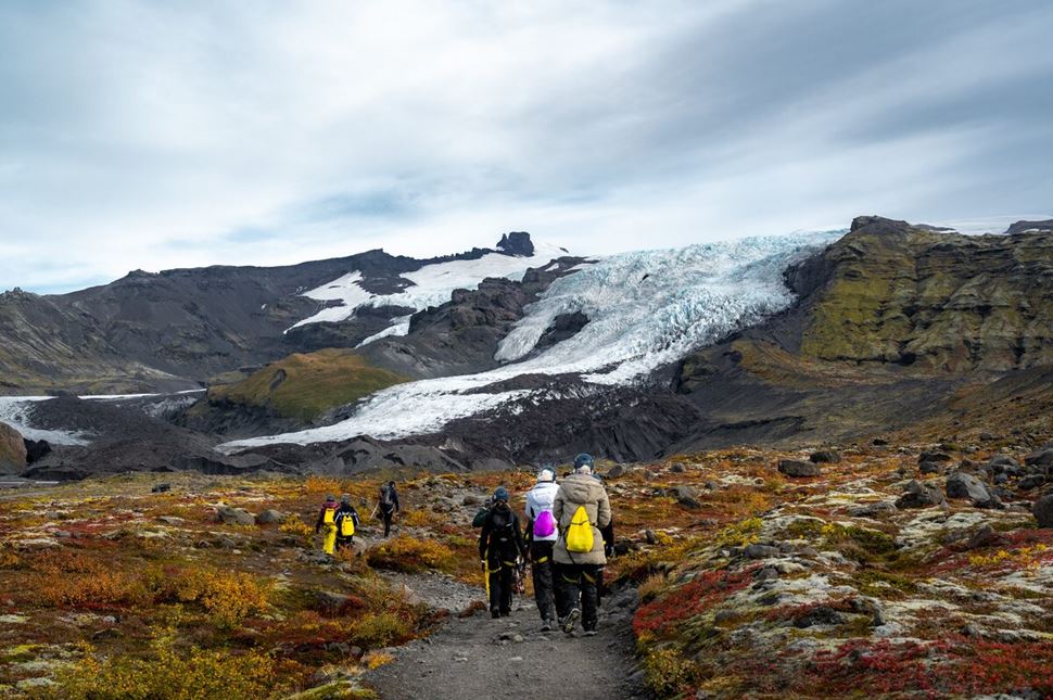
Tour group going towards Vatnajökull Glacier. Source: Arctic Adventures.
Glaciers are essentially layers of accumulated snow in cold regions, gradually compressing into dense ice over centuries because they don’t fully melt during summer. After the last Ice Age ended around 10,000 years ago, Iceland was nearly ice-free, but colder conditions returned about 2,500 years ago, shaping the frozen landscapes we see today.
These massive formations vary in size and type, from expansive mountain sheets to sharp ice peaks, demonstrating the country’s impressive and diverse terrain.
Mountain glaciers, commonly called Alpine glaciers, form in high-elevation regions, confined by the surrounding terrain. Eiríksjökull, a great example, is located in western Iceland in the middle of the Hallmundarhraun lava field.
Valley glaciers can flow beyond the snow line and are restricted on the sides by hills and mountains. In most cases, they originate from bigger ice bodies, like Sólheimajökull, which flows from Mýrdalsjökull.
Piedmont glaciers form when ice streams down a steep valley and run out into a flat plain. Some are remarkably symmetrical, like Breiðamerkurjökull, which flows down from Vatnajökull and almost reaches the ocean.
Cirque glaciers, named after the French word for “amphitheater,” form in bowl-like hollows high up on mountain slopes. They tend to be wide rather than long, like the small icy patch on Mt. Sauðhamarstindur, part of Vatnajökull National Park.
Ice aprons are small icy features that cling to the sides of steep mountains. Öræfajökull, for example, is known for its incline and relatively small size. These wonders often spread out wide but don’t extend very far down, and their precarious positions can lead to avalanches.
Rock glaciers form in steep valleys where rocks and soil can fall from the hills into the ice, resembling sprinkles on an ice-cream dessert. Most of the 167 glaciers in the Tröllaskagi Peninsula are of this type, coexisting with cirque ones.
Ice caps are essentially miniature ice sheets that cover less than 19,305 mi² or 50,00 km². They significantly influence local climates and ecosystems. Bigger ones stretch out into outlets. For example, Vatnajökull, the largest glacier in Europe, rests on a volcano system and spans 3,127 mi² (8,100 km²) with over 30 outlets.
Glacier outlets are extensions of more prominent glaciers. They stretch away from the center and can even reach the ocean. Due to their smaller size, they are popular hiking destinations. Svínafellsjökull, a tongue of Vatnajokull, is famous for its adventure-filled tours.
Ice fields act as domes, covering the underlying terrain. They spread out in all directions and aren't restricted to valleys. Langjökull drapes over mountains and valleys like a blanket of ice, creating a flat area perfect for easy exploration.
Ice streams are massive rivers of ice that flow within bigger sheets or glaciers. They act like highways, carrying ice from the center of the sheet to the outer edges, where it may eventually break off. Skeiðarárjökull, for example, melts from the geothermal activity below from the middle of Vatnajökull and moves towards the Atlantic Ocean.
Glacier lagoon is a unique topographic feature that only appears under certain conditions. As the ice from a glacier crumbles into the ocean, it melts into icebergs, creating a pool of floating blue and white chunks of ice streaked with ash. Jökulsárlón is considered to be the most famous of this type, fed by the Breiðamerkurjökull outlet.
Starting northeast of Reykjavík, just 93 miles (150 km) away, is Langjökull, Iceland’s second-largest glacier, known for its ice tunnels and proximity to the Golden Circle travel path.
Heading inland to the Highlands, Hofsjökull sits centrally, feeding rivers like þjórsá (the longest in Iceland), Héradhsvötn and several others.
Moving west, Snæfellsjökull on the Snæfellsnes Peninsula is an ice-capped stratovolcano. Far in the northwest lies Drangajökull, Iceland's northernmost and fifth-largest ice cap. It’s located in the Westfjords region.
Heading south from Reykjavík on Route 1, Mýrdalsjökull is the first glacier you encounter on the road. It covers the active Katla, one of Iceland's most famous volcanoes. Its famous outlet, Sólheimajökull, stretches out like a leg with distinctive volcanic ash streaks.
Further southeast is the massive Vatnajökull, covering about 8% of Iceland and hiding active volcanoes like Bárðarbunga underneath.
These are just the big ones—plenty of other formations are scattered across Iceland. From smaller snow patches to frozen peaks, there’s always more ice around the corner!
Many of the 269 glaciers are too small to notice—but they all play a crucial role in shaping the country and the planet.
These ice giants feed rivers, influence weather patterns, and support marine ecosystems. Some of the largest ones are essential to Iceland's ecology. If these glaciers were to disappear, global sea levels could rise by about one centimeter, highlighting their critical importance to environmental stability.
Every one of their names ends with 'jökull,' which translates to 'glacier' in Icelandic. Here, we list the names of glaciers in Iceland, covering the larger ones known for their sightseeing opportunities and significance in the landscape.
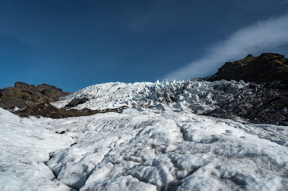
Scenic view of the Vatnajökull Glacier. Source: Arctic Adventures.
The largest glacier in Iceland and Europe, Vatnajökull Ice Cap is like no other in the world. Though shrinking yearly, it spans an impressive 3,127 mi² (8.100 km²), covering nearly 8% of Iceland. It’s so big that it forms one of the three National Parks in Iceland. Its thickest point is almost 3,280 feet (1 km), and though shrinking every year, it still has a prominent effect on Icelandic life and culture. Volcanic eruptions and geothermal heat melt the ice cap from below, causing crevasses, glacial floods (jökulhlaups), and structural changes. With at least 30 stunning outlets, this region is a top spot for hiking and ice caving excursions.
Location: South Coast, 200 miles (320 km) away from Reykjavik.
Coordinates: 64.4220° N, 16.7902° W.
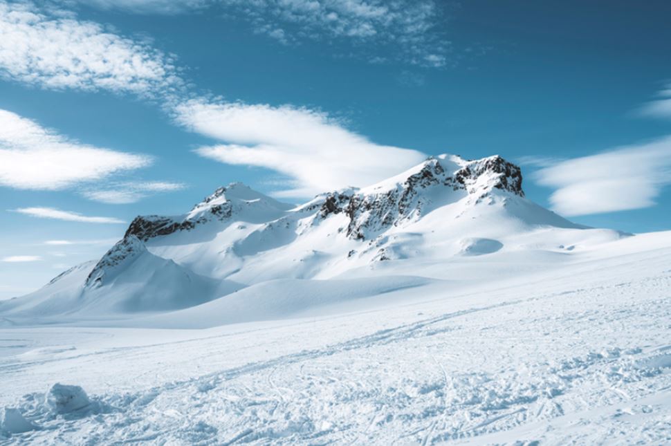
The icy peaks of Langjökull Glacier. Source: Arctic Adventures.
You won’t find a better playground than Langjökull Ice Field, the second-largest glacier in Iceland and the closest one to the capital, Reykjavik. Spreading 395 mi² (1,025 km²), it’s rich in mesmerizing ice formations, deep crevasses, and open horizons of snowy landscapes - popular for snowmobiling. The engineered ice tunnel inside it is the longest in the world, making it a unique destination. This icy giant’s impact extends to surrounding attractions, too. Its meltwater fuels nearby waterfalls, including the iconic Gullfoss on the Golden Circle.
Location: Reykjanes Peninsula, just 93 miles (150 km) away from Reykjavik.
Coordinates: 64.6562° N, 20.1531° W.
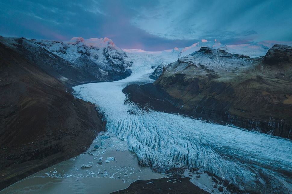
Svínafellsjökull, the glacial tongue of Vatnajökull. Photo taken by: Gunnar Gaukur Guthmundsson.
Covering an area of 4.2 mi2 (10.8 km2), Svínafellsjökull Valley Glacier is an outlet located in the Skaftafell Nature Reserve within Vatnajökull National Park. Once a prime spot for glacier hiking and sightseeing, it is now unsafe for close exploration due to landslide risks from the surrounding unstable mountains, a result of the glacier’s ongoing retreat. A small lagoon has formed at its base as the ice melts, as evidence of the evolving landscape. Visitors are encouraged to enjoy the view from a safe distance and choose nearby glaciers like Falljökull as safer alternatives for hiking.
Svínafellsjökull is also known for its appearances in major blockbuster movies such as Interstellar, Batman Begins, and Game of Thrones, making it not only a natural wonder but a cinematic icon as well.
Location: Skaftafell Nature Reserve, part of Vatnajokull National Park, 204 miles (328.9 km) from Reykjavik.
Coordinates: 64.0016° N, 16.8812° W.
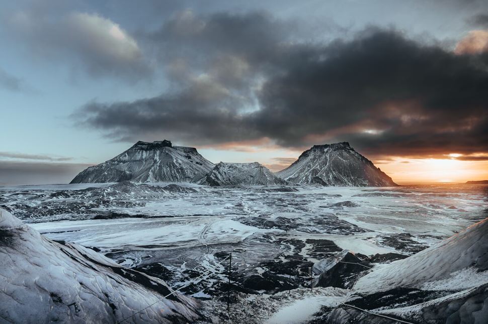
Sun rising behind the Mýrdalsjökull Glacier. Photo by: Bessi Friðþjófsson.
Covering the active Katla volcano, Mýrdalsjökul Ice Cap is the 4th largest glacier in Iceland, spanning 232 mi² (600 km²). It has two major outlets, Sólheimajökull and Kötlujökull, which are open to visitors for various adventurous activities, such as hiking and ice climbing. Additionally, between Mýrdalsjökull and its neighbor Eyjafjallajökull lies the Fimmvörðuháls pass, a famous hiking route that offers stunning views of both glaciers.
A natural ice cave underneath the wonder remains frozen all year round, making it a must-visit destination for travelers. You can explore this amazing formation from top to bottom on the Katla Ice Cave Tour at any time of year.
Location: South Coast, near Þórsmörk Valley, 109 miles (176 km) away from Reykjavik.
Coordinates: 63.6467° N, 19.1303° W.
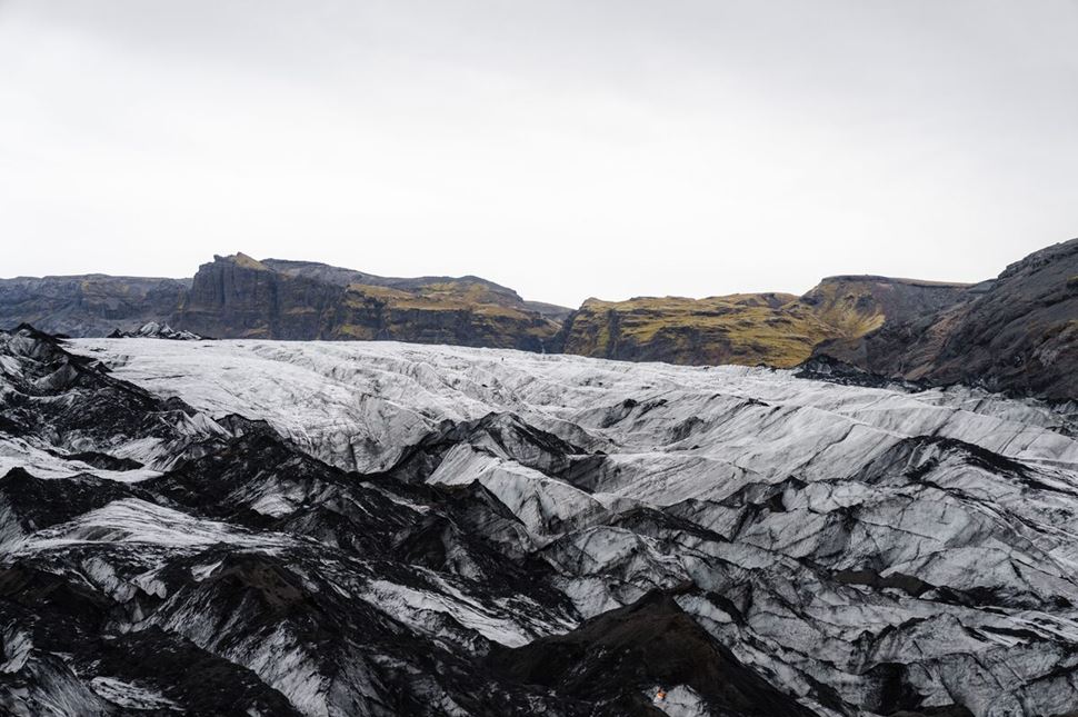
Solheimajökull outlet glacier flowing like a river in a valley. Source: Arctic Adventures.
Stretching from Mýrdalsjökull towards Route 1, the Solheimajökull Valley Glacier is the best for hiking and ice climbing adventures and is known for its ash-brushed ice. Interestingly, it’s located between two active volcanoes, Katla and Eyjafjallajökull. The 16.9 mi² (44 km²) of this landscape is filled with intriguing sinkholes, crevasses, and ice formations. It is one of the most popular places to explore the fascinating labyrinth of ice ridges, with walks and guided ice-climbing expeditions.
Due to climate change, Sólheimajökull has become one of the fastest melting glaciers on the island, with around 0.8 mi² (2.2 km²) of ice already gone. Since 2000, it has retreated over 1 mile (1.5 km), forming a glacial lake that continues to expand as the glacier melts. In 2022 alone, the glacier receded by 2,500 feet (763 meters).
Location: South Coast, 102 miles (165.4 km) from Reykjavik and 19 miles (31.9 km) from Vik town.
Coordinates: 63.5569° N, 19.3028° W.
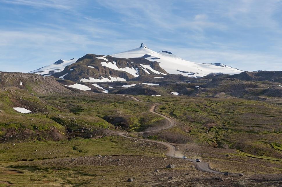
Snæfellsjökull Glacier, surrounded by green landscapes and hills. Source: Arctic Adventures
Featured in Jules Verne's 1864 novel Journey to the Center of the Earth, Snæfellsjökull Ice Cap is one of the most famous glaciers in the world. Situated at the westernmost point of the Snæfellsnes peninsula, surrounded by charming fishing villages, it covers an area of 4.2 mi² (10.8 km²) and sits on an active 700,000-year-old stratovolcano of the same name.
The glacier is shrouded in legends, most of which revolve around Bárður Snæfellsás, a creature capable of controlling the weather who resides in one of the ice caves. Tourists flock to it for its beauty, where the green hills allow the snowy peak to stand out. Some can reach the top by going on a snowcat tour and passing through the surrounding lava fields.
Location: Snæfellsnes Peninsula, 128 miles (206 km) from Reykjavik.
Coordinates: 64.8057° N, 23.7731° W.
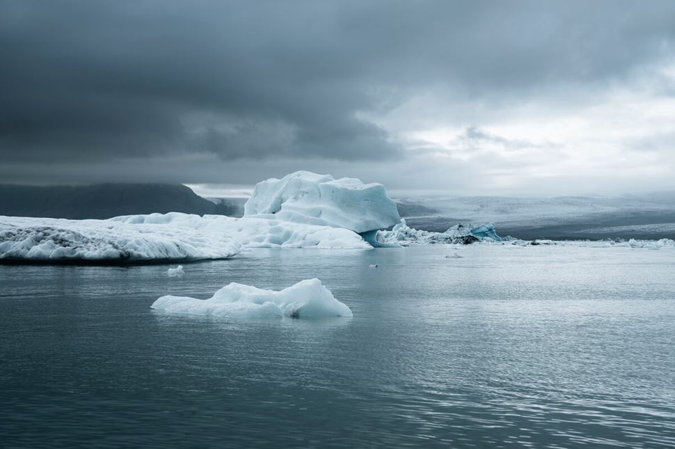
Breiðamerkurjökull Glacier melting into Jökulsárlón Lagoon. Photo by: Gunnar Gaukur Guthmundsson.
Breiðamerkurjökull Piedmont Glacier, an extension of the larger Vatnajökull Ice Cap, is tucked into the stunning South Coast and surrounded by Iceland's iconic attractions. As this 6.5 mi² (16.8 km²) ice cap retreats and breaks at the edges, icebergs fall into the blue waters of the famous Jökulsárlón Lagoon and slowly drift towards the Atlantic Ocean.
This outlet is famous for the incredible crystal ice caves that form in its valley. As summer approaches, the meltwater shapes the ice, and in winter, the caves are reborn, offering a different experience every year. The ice caves are incredibly beautiful and popular with visitors; however, they can only be accessed from October to April. If you are hoping to visit, make sure to join a guided Breiðamerkurjökull ice cave tour.
Location: South Coast, Vatnajokull National Park, 220 miles (355 km) from Reykjavik.
Coordinates: 64.1531° N, 16.4000° W.
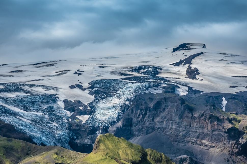
Eyjafjallajökull Glacier view from Thorsmork Valley. Source: Arctic Adventures.
Eyjafjallajökull Ice Cap is an internationally recognized landmark, particularly after its 2010 eruption. It is one of the few stratovolcanoes, or composite volcanoes, in Iceland, meaning it has a conical shape made up of layers of hardened volcanic material like pumice, tephra, and lava. An ice cap covers the caldera of the volcano, which gives it the potential to erupt beneath the glacier. Most people know the name Eyjafjallajökull because of this volcanic activity.
The glacier, which survived the 2010 eruption, saw its ice melt as magma rose, releasing ash and gas that disrupted European air traffic. Although much of the glacier remained intact, the eruption created a unique ash-covered landscape across 38 mi² (100 km²). Sadly, this sight is gradually shrinking due to rising temperatures and ongoing glacial retreat.
Location: South Coast, 93 miles (151 km) from Reykjavik and 26 miles (42.4 km) from Vik.
Coordinates: 63.6314° N, 19.6083° W.
Eiríksjökull - flat-topped glacier just above Langjokull. It marks the border between the Highlands and West Iceland.
Hofsjokull - ice cap sitting on top of an active volcano. It’s located right in the middle of Highlands.
Falljökull - Vatnajokull outlet with an icefall that crashes down the mountain towards Route 1.
Kvíárjökull - outlet with dramatic moraines and unique glacial forelands. Created ice-dammed lakes at its bottom.
Fláajökull - a tongue of Vatnajokull that once extended into the lowlands, retracting around 1.24 mi (2 km) over the past hundred years.
Dyngjujökull - the only part of Vatnajökull where the ice thickens. Since 2010, the ice on this glacier rose around 49 ft (15 m).
Drangajokull - the largest ice cap in the North and the only one in the Westfjords. It remains stable and is not retreating.
Hoffellsjökull - a tongue of Vatnajökull flowing through the Geitafell volcano. It provides water to Hofn town residents.
Heinabergsjökull - a part of the Heinaberg area. Its icebergs and meltwater float into Heinabergslón Lagoon.
Morsarjokull - a glacier that supplies the Morsárlón Lagoon and Morsárfoss, the tallest waterfall in Iceland.
Skeiðarárjökull - the southern tentacle of Vatnajokull, plays a pivotal part in shaping the Skeiðará River.
Tindfjallajökull - a small glacier in the south, sitting on a large volcanic crater and surrounded by Tindfjöll mountain ridge.
Iceland’s frozen regions are some of the most impressive and accessible in the world. Experience these majestic landscapes with our glacier tours in Iceland - curated icy adventures focusing on one or more activities.
Unique and exciting walking excursions in Iceland allow you to discover the world of ice from the top of natural wonders.
From stunning scenery to ash-streaked ice formations and deep crevasses, it’s your chance to explore the nooks and crannies of the many outlets of Europe's largest glacier on a Falljökull glacier hike, including the famous Sólheimajökull glacier tour.
Equipped with helmets and crampons, you'll walk across the icy surface, navigating ridges, crevasses, and moulins. As you hike, your certified guide will explain the glacier’s history, its current state, and the effects of climate change on these natural giants.
When glaciers move and melt, the meltwater flows through the thinner parts of the ice, leaving a space or tunnel that runs through these large landforms.
These hollows are called ice caves and are often large enough to walk through. From October to April, ice-caving tours are one of the most popular activities in Iceland. Some, such as Katla, are stable enough to be visited all year round.
To reach the caves, you either hike across the glacier or, in some cases, ride in a special vehicle that takes you close to the entrance.
Snowmobiling on a glacier is a wildly popular activity you can enjoy all year round in Iceland.
Thrill seekers can ride on the surface of several of Iceland's glaciers, race across a snowy wonderland on the action-packed Langjokull snowmobiling expedition, and weave through formations found nowhere else in the world.
Another popular snowmobiling destination is the Eyjafjallajökull glacier, where you can take in breathtaking views as you ride through the majestic snowfields.
The sheltered waters and floating giant icebergs make lagoon kayaking well worth exploring.
Grab a paddle and wander among the incredibly shaped icebergs dressed in brilliant blue, dazzling white, and ashen charcoal. Glide across the calm waters of the Jökulsárlón glacier lagoon on a kayak tour, or immerse yourself in the deep beauty of the Sólheimajökull glacier as you weave in and out of the icebergs.
Don’t just scratch the surface—immerse yourself in Iceland’s stunning glacial landscapes. There are so many ways to experience these icy wonders, so let's find the adventure that suits you best. The only limit is your imagination (and sometimes the weather).
Unfortunately, glaciers in Iceland are melting at an alarming rate, which is a growing concern among scientists and environmentalists.
While it’s natural for glaciers to shrink and expand annually, rising global temperatures have disrupted this delicate cycle. During summer, glaciers release meltwater into rivers and oceans, and winter snowfalls allow for recovery. However, the warmer-than-usual temperatures prevent them from regaining their mass.
Since the early 20th century, this process has accelerated, with the retreat of outlet glaciers increasing rapidly, leading to some of the most significant ice reductions worldwide. Between 2000 and 2019, Iceland’s ice sheets lost around 7% of their size, with projections indicating they could decrease up to half in their volume in the near future.
In 2014, Okjökull became Iceland’s first glacier to be declared "dead" due to global warming, a symbol of the ongoing changes. Unlike "living" glaciers, which flow and accumulate snow, Okjökull had lost its movement and vitality. This marked a significant environmental milestone, monumentalized by the plaque, ‘A letter to the future.’
Our generation has a unique opportunity to witness these magnificent ice formations while they still exist. However, we must take steps to protect them and raise awareness of climate change. By learning about their current state, we can help ensure their preservation for future generations. It’s vital to take action now to safeguard these natural wonders and educate others on their importance.
Yes, Iceland is dotted with many ice caps of various sizes. The largest is Vatnajökull, which composes around 8% of Iceland’s surface, making it the biggest in the nation and Europe. Following it are the well-known Eyjafjallajökull, the striking Snæfellsjökull, and the impressive Mýrdalsjökull. Last is Drangajökull, the only icy wonderland in the Westfjords.
Iceland’s massive glaciers are mostly retreating due to the effects of climate change. Higher temperatures are disrupting their natural cycle, where they melt in summer and rethicken in winter. This imbalance has already erased Okjökull from the map. If the situation does not improve, more will follow in the upcoming decades.
Langjökull is 93 miles (150 km) away from Reykjavik, and it takes around 2 hours to reach it. If you’re driving yourself, head toward Thingvellir on Route 36, switch to Route 52, and continue along Road 550 to reach the glacier’s parking lot.
Solheimajokull and Falljokull are the most accessible glaciers for exploration in Iceland. Their proximity to Route 1, the main road around the island, allows people to reach them with their cars without the need to go through the bumpy roads of the Highlands region. Due to their versatility, guided tours allow people to explore them in various ways, ranging from different levels of hiking to ice climbing.
Yes, it is possible to drive to Sólheimajökull by car. If you start in Reykjavik, it is a straightforward journey. Simply take Route 1 (Ring Road), heading east for about 2 hours. Then, turn left on Route 221 and continue for 2.4 mi (4 km) until you arrive at the parking lot.
Small glaciers in mountain valleys are called alpine or mountain glaciers. In Iceland, they take shape from snow piling up over many years. As they grow and "flow" down the valley, they adapt to the terrain and earn the name Valley Glacier. When they become strong enough to carve out a U-shaped valley, they become cirque-type glaciers.
Yes, Iceland has glaciers—massive ice formations covering over one-tenth of the island and blanketing the landscape in every direction. From sprawling ice caps that stretch thousands of square miles to smaller glaciers dotting most regions, these icy giants are as much a part of Iceland’s identity as its volcanoes. Visitors can find glaciers near coastlines, atop mountains, and hidden in remote areas.
There are about 269 glaciers in Iceland, according to an inventory that was carried out around the year 2000. Recent studies have focused on measuring their volume, revealing significant decreases rather than just counting individual glaciers. Some glaciers have disappeared or been classified as "dead ice," including one declared extinct in 2014, making the exact number of glaciers today uncertain.
Iceland’s glaciers are primarily clustered in the south, southeast, and highlands. The largest, stretching over much of the southeast, is situated within Vatnajökull National Park and covers about 8% of Iceland's land area. The highlands also feature other massive glaciers, while several smaller ones are scattered across the western and northern areas.
Vatnajökull’s origins trace back to the last Ice Age, which ended about 12,000 years ago. However, it began to form its current shape around 1,500 years ago, as smaller glaciers from the surrounding highlands merged. Snow and ice gradually compacted over millennia, expanding into the massive ice cap we see today.