Every night could be an aurora night. Don't Miss Out
Eldfell is a volcano located on the Westman Islands, just off Iceland’s southern coast. Once a destructive force of nature, it has become a popular hiking destination, with sweeping views of the vast Atlantic Ocean and a sparkling archipelago. From its dramatic impact on the island to its influence on local culture, the red slopes of Eldfell are steeped in history and brimming with opportunities for adventure!
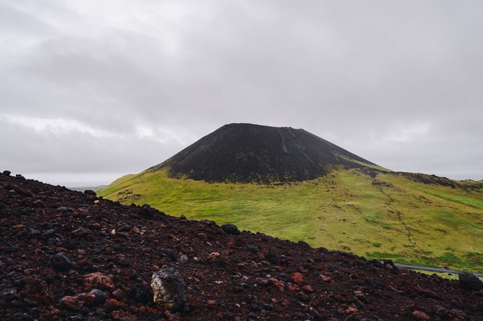
Red cone and green slopes of a volcano on the Westman Islands. Source: Gunnar Gaukur.
Though not the oldest volcano in the Westman Islands archipelago, Eldfell is the most prominent on the main island. While only 200 m (656 ft) tall, it covers a broader area than Helgafell, an older volcano that stands slightly taller at 227 m (745 ft). The reddish slopes clearly distinguish this younger formation, a feature that inspired the Icelandic name, “Eldfell,” meaning “Hill of Fire.” These fiery slopes are complemented by a sprawling lava field that reaches the coastline, forming a wide, pancake-like shape when viewed from above.
Eldfell is located on the eastern side of Heimaey, the largest island in the Westman Islands archipelago and home to around 4,500 residents. The nearest settlement, Vestmannaeyjabær, lies just 2.5 km (1.55 mi) west of the volcano. Even closer is Helgafell volcano, only 1.5 km (0.93 mi) away, and Urðaviti Lighthouse, situated 2.2 km (1.36 mi) from Eldfell. Though the Heimaey Harbor is 4 km (2.48 mi) away, an extensive lava field bridges the gap between the harbor and the volcano, adding green and dark undertones to the whole landscape.
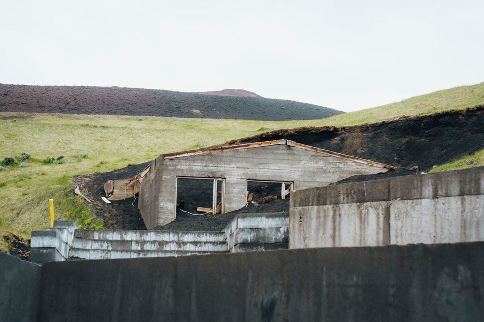
Remnants of a lava-covered building on Heimaey island. Photo by Gunnar Gaukur.
Eldfell is best known for a volcanic eruption that rocked this region and almost sealed its economic and tourism lifeline. To set the stage: over the past 5,000 years, this set of pearls experienced only a handful of eruptions and enjoyed long stretches of relative calm. That peace shattered on January 21, 1973, as tremors began to ripple through Iceland and tension started to build up. Two days later, on January 23, the first fissures appeared near the center of the town (The Atlantic).
What followed was a six-month-long Eldfell eruption that upended life for Heimaey’s roughly 5,000 residents. Columns of ash replaced fluffy clouds and covered the sky in darkness. Lava poured from the earth, consuming homes and infrastructure, turning parts of the island’s green terrain into a blistered, scorched landscape. Media turned their attention to this dramatic showdown—nature versus the people of Iceland—unfolding just off the country's southern coast.
Much of the focus centered on the lava advancing toward Heimaey Harbor, the island's critical connection to the mainland. It was a race against the clock, and somehow, Icelandic emergency workers (and some US military personnel) slowed down an impending doom. They used cold seawater pumped via pipes to successfully cool the hot volcanic liquid. A genius idea in a moment of immense stress.
So, did anyone die in the 1973 eruption of Eldfell? Fortunately, no. Thanks to a swift evacuation by fishing vessels and government boats, all residents escaped in time. A few volunteers remained behind to assist firefighters and police, ensuring the safety of the community. In the aftermath, recovery efforts began—clearing ash, repairing damage, and rebuilding lives. From then on, whenever locals looked to the east, they were greeted by a new presence—Heimaey volcano, an active, yet not dangerous, reminder of nature’s power and the resilience of those who endured it.
Eldfell is a cinder cone volcano, where a mixture of ash and debris surrounds a volcanic vent. Originally 220 m (721 ft) tall, the wonder eroded in time to a 200 m (656 ft) formation. This Westman Islands volcano makes up for the loss with the large lava field that drapes the island's western parts.
Though the “Eldfell Area”—the volcano and its surrounding lava field—remains uninhabited, it is far from lifeless. Locals have launched ecological efforts to introduce much-needed greenery into a charred landscape by planting grass to soften its darker undertones. Paved and gravel roads weave around the landscape toward Urðaviti lighthouse and the Atlantic shoreline, inviting tourists to explore a surreal world that still exists today.
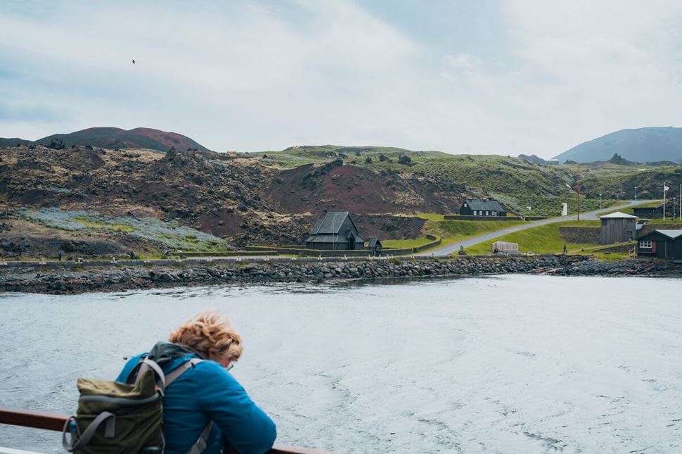
Shifting landscapes around Eldfell are perfect for challenging hikes. Source: Arctic Adventures.
From the Eldheimar Museum, the path of Eldfell volcano hike climbs through black ash and red volcanic gravel. Eldfell’s cone rises ahead, streaked with burnt-orange slopes from the 1973 eruption. As you gain height, Heimaey town drops behind and views of the sea open up. Occasional warm spots in the ground hint at the volcano’s young age, while the salty breeze and faint whiff of sulfur follow you up the trail.
You can choose between two main routes: heading left with the volcano on your right, or walking between Eldfell and the older Helgafell volcano. The second option is the most popular, offering a steady climb and dramatic views of both volcanic peaks. The trail is marked with wooden posts and worn dirt paths, so navigation is simple even for first-time visitors.
The first 20 minutes bring you to a plateau with your first sweeping view over Heimaey Island. From here, the slope steepens as you climb to the rim. The ground underfoot is loose volcanic gravel, so take it slow. At the summit, 200 m (656 ft) above sea level, you’ll find a 360-degree panorama of the Atlantic, the clustered houses of Vestmannaeyjabær, and rocky sea stacks rising from the waves. You can follow the narrow ridge around the crater for different perspectives, each showing the power and reach of the eruption that reshaped this island.
The descent is slower than it looks—about 30 minutes down the loose slopes—so take your time. If you’re exploring on foot from town, add another 10–20 minutes each way. On clear days, the light brings out deep reds in the lava and the vivid blue of the surrounding sea, making the hike a rewarding combination of raw geology and island scenery.
Quick tips for hiking Eldfell
From the top, the mix of ocean, town, and volcanic terrain makes Eldfell one of the most rewarding short hikes in Iceland.
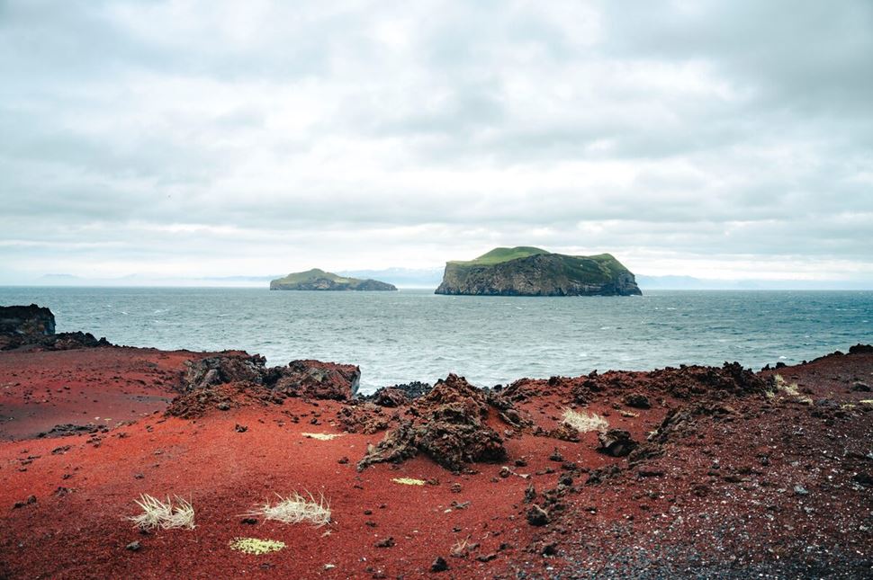
Volcanic islands make up the Vestmannaeyjar chain. Photographed by Gunnar Gaukur.
Beyond Eldfell’s striking red slopes, the Westman Islands pack in plenty more to see and do. You’ll find museums that bring the 1973 eruption to life, sea cliffs buzzing with birdlife, and unique rock formations worth the short detour. Some stops add rich context to your hike, while others are simply unforgettable sights that make the trip even more rewarding. Here are a couple attractions worth your time:
A gallery that glimpses into the wildlife of the Westman Islands. You’ll find exhibitions displaying stuffed birds, various minerals and rocks, and 12 fish tanks, collectively known as the aquarium, filled with marine life. During the 1973 eruptions, lava flow damaged parts of the museum and cut off the power, but everything is back—in a much better state—today!
A peninsula on the southernmost point of the main island, Heimaey. Where Eldfell was a force of destruction, Stórhöfði is a place of life, with Icelandic puffins flocking to the ridges to live and raise their chicks in summer. To avoid disturbing these colorful birds, you should visit this area with a guide and keep your distance where possible.
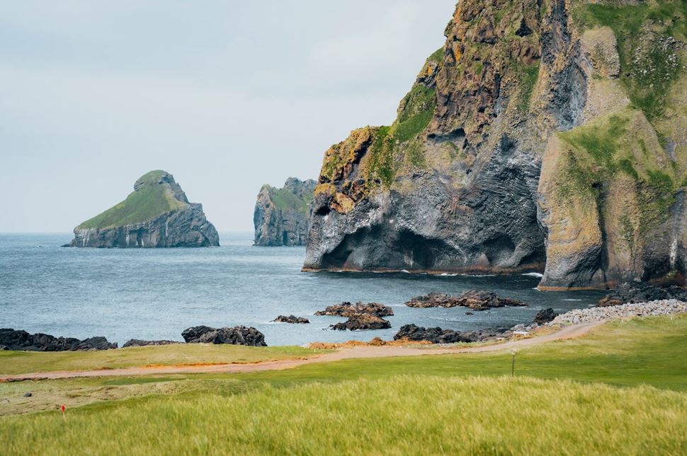
The Elephant Rock from Heimaey's shore. Source: Arctic Adventures.
A rock formation in the northwestern parts of Heymaey that resembles an elephant. The timing of its formation is still debated, with many believing it was born during the 1973 eruption. Others think the Elephant Rock came about during another eruption within a 15,000-year window, and water and waves eroded it into its current shape.
A natural haven north of Vestmannaeyjabær, serving as the main island's lifeline to the world. Ships—full of tourists or cargo—float into the blue waters here daily. The lava flows, which once posed an immense danger to the harbor, now fashion the shoreline and welcome all travelers to the Westman Islands.
A volcanic island and the southernmost part of the Westman Island chain. The base of this wonder was formed in 1963, but expanded in the following years to 2.58 sq. km (1 sq. mi). However, erosion gradually reduced the territory to around 1.3 sq. km (0.5 sq. mi). As Surtsey is a designated UNESCO site, plants and animals here live undisturbed, and tourists are prohibited from visiting. View it from a safe distance on a boat tour in the area.
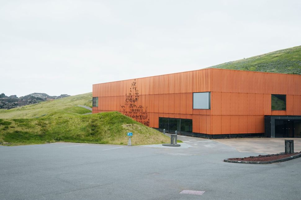
The Eldheimar museum is near the Eldfell volcano. Source: Arctic Adventures.
A significant landmark on the Westman Islands is the Eldheimar Museum, which focuses on the 1973 eruption and other volcanic activity in Iceland. The site opens a window into history and examines the damage and aftermath of the Eldfell explosion through exhibitions and audio guides. One exhibit focuses on a destroyed family home, now an example of how Mother Nature can turn all plans upside down. Visitors can walk around it or glance into the interior via remote cameras. Another display glances at the creation and history of Surtsey, the newest addition to the Westman Islands chain.
Though the museum is open every day, its work hours are not always the same. For example, from May 11th to September 14th, the doors open from 11 AM to 5 PM, while during the off-season, the hours are much shorter. You can find it in the southeast corner of Vestmannaeyjabær, near the base of Eldfell itself. Eldheimar is around 1.6 km (1 mi) or 30 minutes on foot away from the harbor. A car drive can get you there in 4 minutes.
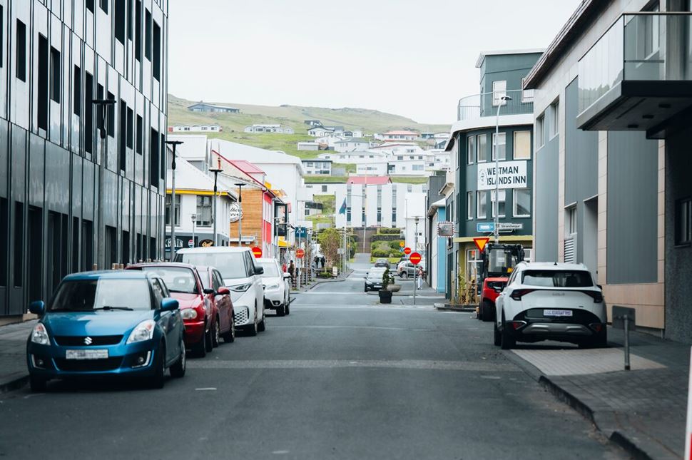
Streets of Vestmannaeyjabær, the Westman Islands' main town. Captured by Gunnar Gaukur.
While there are no accommodations directly at or near Eldfell, several options await in the nearby town of Vestmannaeyjabær. Hotel Vestmannaeyjar, located near the town center, offers amenities such as a bar and sauna, ensuring a comfortable stay. Budget travelers might prefer the neighboring Aska Hostel to connect with fellow adventurers. For those who enjoy the outdoors, designated spots allow for tent camping, mobile camping, and glamping.
When it comes to dining, expect cozy local restaurants rather than familiar franchises. Gott, a family-run eatery, serves creative dishes made with fresh ingredients—think hearty stews, soups, and more. Einsi Kaldi, located inside Hotel Vestmannaeyjar, specializes in seafood, offering inventive and fresh options. Exploring the town, you’ll also find lively bars, a kebab shop, and other eateries to satisfy your appetite.
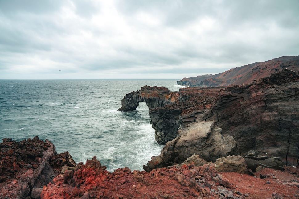
Rocky slopes of the Vestmannaeyjar island in May 2025. Source: Arctic Adventures.
Eldfell shines in the summer's almost 24 hours of sunlight. As the weather in Iceland and the Westman Islands improves, temperatures can reach as high as 13°C (55.4°F) in July. Once covered by snow, the green grass and red ascending slopes reveal their full beauty to hikers and distant sightseers. However, be prepared for larger crowds, as this season's tourism to the archipelago reaches its peak.
Winter, by contrast, is Iceland’s low season, bringing a quieter, more solitary experience. Durin this time, the red Mountain of Fire coats itself with an icy white layer of snow. Despite the beauty, packing the right items becomes even more critical as snowfall intensifies and temperatures dip into the lower degrees.
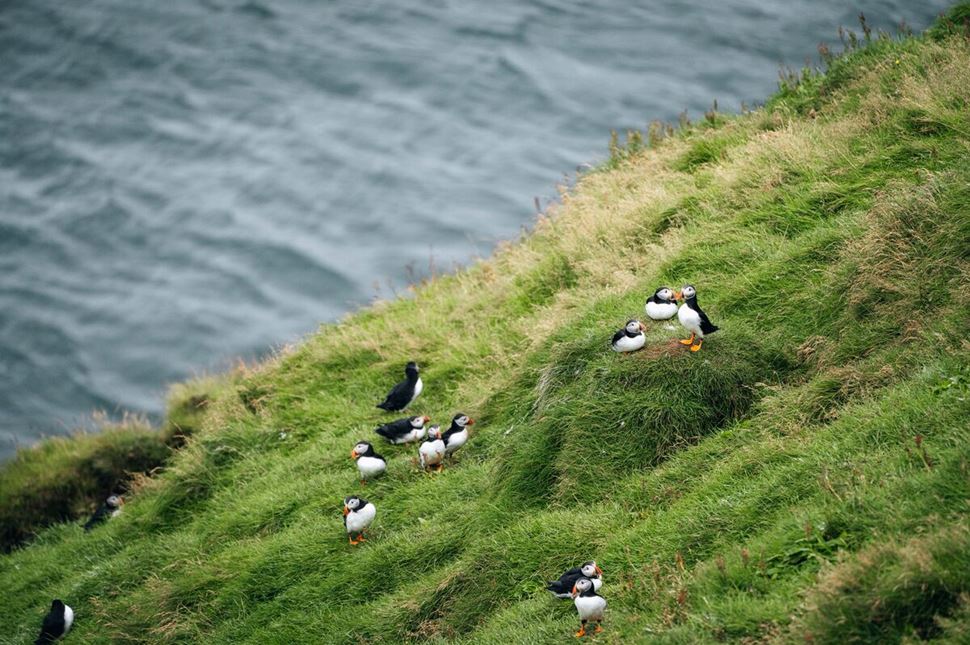
Westman Islands host one of the largest puffin colonies in Iceland. Photo by Gunnar Gaukur.
Guided volcano tours on Heimaey island run from June to September, making summer the best time to join one. These are among our most popular local experiences, giving you the chance to hear stories from knowledgeable guides while exploring one of Iceland’s most dramatic volcanic sites. If you only have a day, the One-Day Westman Islands, Volcanoes & Puffins tour is a solid pick — it covers a hike up Eldfell plus stops at key landmarks and volcanic formations near the main town. For a more in‑depth trip, the 3-day Iceland’s Highlands and Volcano Adventure includes Eldfell, the Eldheimar Museum, and a range of South Coast highlights, which will give you a deeper dive into Iceland’s volcanic history and scenery.
Yes, Eldfell is still classified as an active volcano, with its last eruption occurring in 1973. For five to six months, tremors shook Heimaey Island as lava erupted and flowed, creating a vast lava field that nearly sealed off the island’s natural harbor. However, there are no signs of volcanic activity today and the volcano remains quiet.
No one died directly from the eruption, but the surrounding area was damaged. For five months, lava flowed, destroying houses and crops, and, worst of all, was on the path to fill in the natural Heimaey harbor—the island's lifeline. Thanks to a powerful Icelandic-US partnership, the disaster was averted by pumping tons of water onto the lava, cooling it down.
Eldfell erupted on January 23, 1973, and continued until July 5 of the same year. The first signs of unrest were detected two days earlier, on January 21, when mainland seismic stations recorded unusual tremors. Then, without warning, fissures opened on Heimaey Island—alarmingly close to a settlement of around 5,000 residents—catching the entire community by surprise.
Yes, you can drive to the base of Eldfell, but not all the way to the summit. A network of paved and gravel roads wind around the dark slopes, linking both marked and informal parking areas to the nearby town. Navigating Heimaey island is generally easy with a standard 2WD vehicle, whether in summer or winter, though a 4x4 adds stability and traction on steeper or less-maintained roads.
Eldfell’s eruption ended when volcanic activity beneath the surface finally subsided. However, Icelanders' efforts played a crucial role in protecting Heimaey Harbor. As lava threatened to engulf this vital lifeline, emergency crews pumped cold seawater through pipes to cool the advancing magma, slowing its flow and preventing further damage to the harbor.
Eldfell and the Westman Islands lie on the mid-Atlantic ridge between Eurasian and North American tectonic plates. The boundary between them is divergent, meaning that the continents are pulling away from each other, creating energy that ultimately leads to volcanic activity. This leads to eruptions, like the one in 1973, and other geothermal activity throughout Iceland.